


Weather Observations for October 26, 2015: taken at 06:00 Hours.
2240 meters -1, Winds were 15-20 KPH S--Horstman Hut Station
1835 meters +2, Winds were 0-5 KPH from the W
1650 meters +4, Relative Humidity 95%
660 meters +6, Valley Temp, Max Temp Yesterday was +11.6. Trace of rain recorded.
 As of 07:45 Hrs at 1835 meters we have overcast skies with variable visibility. Showers may occur.
 At 2180 meters we have obscured skies with another fresh dusting of the white stuff.


For the forecast, low pressure to our South will bring cloudy conditions for this morning, with unsettled conditions later today as it moves East. Ridge of high pressure will begin to rebuild this evening with sunny conditions for Tuesday. Clouds will begin to build for Tuesday night as another Pacific front moves onshore for cloudy wet conditions on Wednesday. A brief flat dirty ridge may develop for Thursday with unsettled conditions and some showers, before a wet upper level trough with a tropical Pacific influence moves onshore for Friday into Saturday. We can expect light to moderate precipitation with the Freezing level hovering around the local peaks. Will have an update on the wet Halloween on Friday.


ARTICLES:
An avalanche in Kaghan has killed one and injured 9: Pakistan
Forecasters daily routine: WildSnow
Drones and Avalanche control: Colorado
Avy Awareness--November 6, 2015: Whistler, B.C.
Global Temperatures smash September Record by widest margin in history: GeoEngineering
American Avalanche Institute partners with Backcountry Access: BCA
Use Snowpack tests to make better decisions: PowderCanada


First frost Saturday October 24, 2015. Sunrise was at 07:48.

Patricia flooding Texas, Remnant of Olaf off our coast. High pressure prevailed in split flow!

Posted this article last year: DesignMind Another related article: Drones for avalanche mitigation

Upper Joffre Lake.
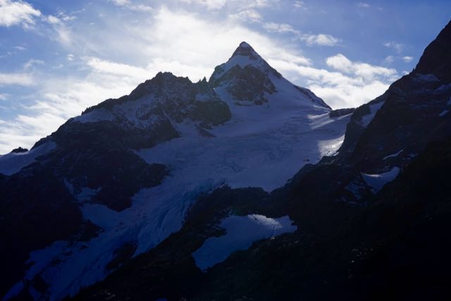
Anniversary Glacier Sunday October 25, 2015.
No comments:
Post a Comment