Recent avalanche activity on Metal Dome, observed on Saturday Oct 22Nd---Jobe O'Conor Pic
Friday morning October 21, 2016--more snow down into the tree line.
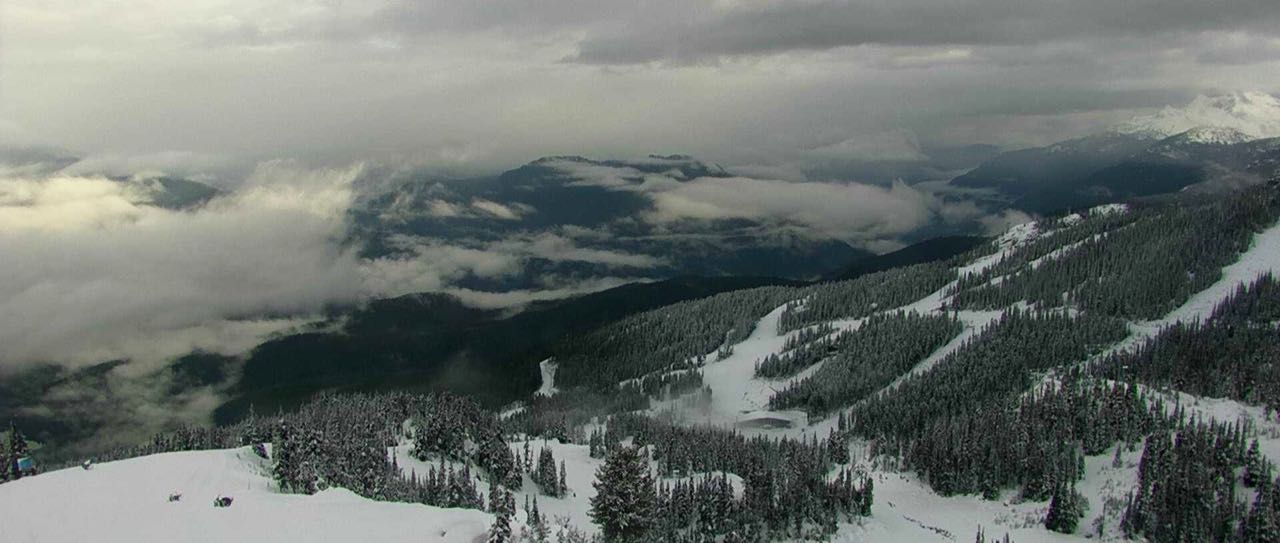
Friday morning, thick cloud moving in our direction.
Snowing in the alpine Friday afternoon.
Light rain and fall conditions in the valley Friday afternoon. 2.2 mm of rain at 660 meters.
Saturday AM 08:30 Hrs, October 22, 2016 -3 with broken cloud.
Image from Saturday Morning.
Awesome morning Saturday.
Whistler Mountain Saturday afternoon.
Saturday afternoon, Cheakamus Lake Views.
Sunday morning October 23, 2016-09:30 Hrs--0 Deg.
Satellite image from the same time frame as above.
Unsettled day in Whistler on Sunday, 0.5 mm recorded at 660 M.
Weather Observations for October 24, 2016: taken at 07:00 Hours.
2240 meters -1, Winds were 35-75 KPH SE --Horstman Hut
1835 meters +2, Winds were 20-25 KPH ESE --Roundhouse
1650 meters +2, RH 100% 2.0 mm of precip --Pig Alley Precip amount since 00:00 Hrs
660 meters +5, Valley Temp, Max Temp Yesterday was +8.5, 0.5 mm of Precip recorded yest
As of 07:30 this am we have broken cloud and unlimited visibility.
Low pressure is slowly moving in from the South. Looks moist!!
For the forecast, yet another deep low off the coast will spread a series of warm surface lows in our direction in a Southerly flow aloft. The low pressure system is moving up the coast, bring with it a warm air mass. Unsettled this morning with a rising FL as the low moves up the coast, expect light showers as it arrives with light rain by this afternoon into the evening. FL could top out at 2200 meters then slowly drop to around 1800 meters by tomorrow, in a SW flow aloft. Tuesday will also see light precipitation with possible breaks by Tuesday evening. A juicier frontal band will arrive for Wednesday with light to moderate precipitation and the FL hovering in the 1800 M range. Thursday will also see some light precipitation and the FL should slowly drop as the frontal band exits the area later in the day. As of now Friday and Saturday look unsettled with a mix of sun and cloud and the chance of some intermittent isolated showers. More on that in Friday's post.

Most of the precip will be South of our zone, luckily.
Big deep low moving up the coast.
Unsettled this am with light precipitation later in the day.
Weak front for Tuesday. May see some breaks by the evening.
Moist and wet for Wednesday.
Weak front band Thursday dissipating by the evening.
Weak high pressure for Friday morning.
Friday will likely be the nicest day of the week!!
ARTICLES:
Alberta Snowmobile Association to provide free avalanche training:
Snoriders
Avalanche centre warns early season skiers:
Montana
Receding glaciers in Bolivia leave communities at risk:
Science Daily
Root cause of outdoor accidents--Have a margin:
Will Gadd
Monthly record warm streak ends-September second warmest on record for globe:
Science Daily
In depth avalanche technician program to be offered at CMC Leadville:
Colorado
OBSERVATIONS:
Seems like Metal Dome was the active zone. Image from Saturday. Steve Jones Pic
|
|
|
| Had a great day out at Tenquille yesterday. So nice to see the sun! A few early season observations from a SW slope: 100cm of snow at 2000m. A crust 30cm down beneath a sun warmed layer. Another crust 70 down with really low density cold snow between it and the ground. There was a giant glide crack ~100m wide just above the lake on the same SW slope. |
|
| |
|
|
| Spectacular light up above Railroad Pass today - managed to skin from the truck at around 1400m with 'minimal' alder difficulty. Fast snow from 1500 up. Probed to the ground at just under a meter at around 1900 on a slight lee feature. Otherwise HS around 75-85 at that elevation. Decent coverage and turns and no wind. No snow on the road until the bridge. |
|
 | |
|
|
Dug a quick pit at ~2200m on NE side of Blackcomb Gl. today (about 200m SE as crow flies from top of Showcase T-bar):
HS 120-130cm sitting on grey glacier ice. The HS could vary +/- 30cm due to heavy wind effect all over there.
While cutting the back side to isolate a column for CT we observed a (very) clean planar shear to pop and move, about 35cm down.
Below that no result but there are were couple of interfaces.
Then there was a reasonably thick crust (~5mm) around 85cm down but seems decomposing - didn't test it.
Lots of slabs have formed due to the winds and I wouldn't be surprised if they surprise :) because while skinning/skied all feels pretty solid.
|
|
|
Hi Wango,
Summited Brandywine peak today. A lot of parties out there today including snowmobiles and snow bikes that stayed low in the valley! Visibility was in and out and winds were calm. Skins on at 1400m with 30cm HS and 7-10cm on a semi supportive thin crust. The crust petered out above 1850m and ski pen averaged 10-15cm. On the glacier the HS was 160-190cm at 2030m. No new avalanches observed, some cracking in isolated wind affected areas with no propagation. I suspect there could be isolated winds slabs to be found in the right locations but mild temps are settling things fast. The sun still has some punch when it comes out, so some old snowballing observed and suspect variable conditions on solar aspects. No ski cut results and overall the snowpack felt well settled. Ski quality deteriorated below 1800m.
Cheers
Jeff Van Driel
Nice looking snow on Brandywine. Jeff Van Driel Image
Great coverage in the Brandywine Area for the end of October. Jeff Van Driel Image
Profile from Horstman Glacier Saturday-Xe produced size 1 surface slabs-Old debris noted in Blackcomb Bowl.
|
|
|
|

Fresh snow in the tree line Friday.
Streams and rivers are pumping. It has been a wet October.
View from Cheakamus Lake on Saturday.
37 cm at 1550 meters as of Saturday at the Catskinner Weather plot.
Blackcomb Sunday afternoon.


No comments:
Post a Comment