25 Nov 2015

November 25, 2015

    Size 1 Na (Natural) avalanches observed Tuesday, likely from Monday evening in storm snow.


    Early Tuesday November 24, 2015.


    Whistler early morning. It looked cold!
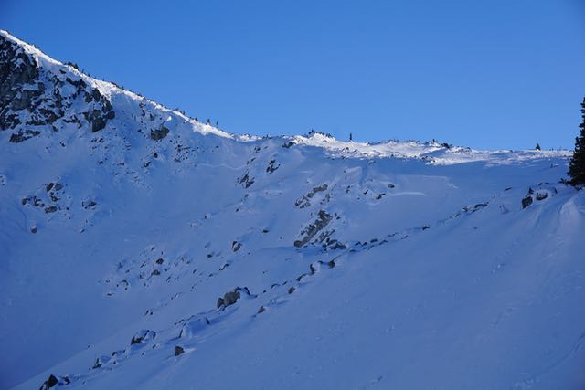

    Strong outflow winds from the N for most of the day. 40-70 kph in the am, 30-60 KPH pm 1865 M 


    Size 1 Na's observed Tuesday, likely ran Monday night or early Tuesday morning.


     Sa (accidental) Wind Slab in Hidden Chute. Tues aft. Temporary Boundary.      Toby Salin Image


     Burnt Stew Glide Crack                                                                              Adam Francis Image


    Sunset Tuesday evening, still see the spindrift which occurred all day.


    Moisture went South Tuesday morning.


    Pretty big high in the big picture!


Weather Observations for November 25, 2015: taken at 06:00 Hours.

2240 meters    -10, Winds were 30-40 KPH NE  --Horstman Hut Station
2180 meters    -10, Winds were 50-80 KPH SSW  --Whistler Peak
1860 meters      -8, Winds were 40-60 KPH NW  --Rendevous
1835 meters      -8, Winds were 5-10 KPH E  --Roundhouse
1650 meters      -7, 0 cm of new, 82 cm Base, Relative Humidity 63%  --Pig Alley
1550 meters      -4, 0 cm of new, 55 cm Base  --Catskinner 
  660 meters      -9, Valley Temp, Max Temp Yesterday was +0.3. Trace of price recorded.

Be careful if venturing out, pockets of windslab and reverse loading.


    As of 07:00 Hrs we have clear skies and unlimited visibility.

For the forecast, the modified Arctic Front will begin to degrade with warmer temperatures this afternoon as the RRR (Ridiculously Resilient Ridge) in the Pacific Northwest begins to strengthen.
The freezing level will rise to around 1000 meters today with valley temperatures hovering around 0 by this afternoon in a Northeast flow aloft. Winds should abate later this morning/afternoon. The full moon this evening (22:44 UTC) will see the FL rise to 2500 meters, topping out on Friday as high as 3000 + meters, with temperatures in the valley fluctuating from 0 to +4 (Day time highs). The ridge remains until Monday and at that time the FL should drop back down to around 800 meters. A front is forecasted to arrive on Tuesday morning. Lets hope so with a favourable FL.

    High amplitude upper ridge well offshore.


    Arctic high will be pushed Eastward this morning.

   Warm temps from the RRR on Friday. Arctic air in the Rocky Mountain Trench.

    Hopefully we will see some precipitation by Tuesday morning.


ARTICLES:

The Human Factor 2.0: SLF

Explanation of a wind slab: NAC

N.H. mother of avalanche victim works to prevent other deaths: GlobeStaff

Snoqualmie Pass avalanches remain dangerous for drivers this winter: King5News


    It was a cold day, but not really cold!! Minimum -14 at 10:00 Hours with 50-85 KPH winds NW.

    Looking toward Mount Currie Tuesday afternoon.

    Great temperatures for making snow.


    That's a lot of water going through the nozzles.

    Snow making stepping up production with the cold temps. Valley Bound.

24 Nov 2015

November 24, 2015


    First Avalanche Fatality in NA this season on Mt Whitney, story in article section below. Net Pic

    Catskinner Weather plot Monday morning. 50 cm Base

    Very light snow Monday, November 23, 2015-- 3 cm recorded at 1650 meters by 14:00 Hours.

    Front over the area on Monday.

    Big picture Monday afternoon.

    Snowing in the valley at dusk.


Weather Observations for November 24, 2015: taken at 06:00 Hours.

2240 meters      -14, Winds were 25-65 KPH SSE     --Horstman Hut Station
2180 meters      -14, Winds were 70-100 KPH SSW  --Whistler Peak
1860 meters      -12, Winds were 35-60 KPH NW       --Rendevous
1835 meters      -11, Winds were 15-40 KPH SSE      --Roundhouse
1650 meters      -10, 8 cm of new,  11 cm in 24 hrs, 82 cm Base.--Pig Alley
1550 meters        -8, 5 cm of new ?, 55 cm Base? RH 90 %  --Catskinner 
  660 meters        -1, Valley Temp, Max Temp Yesterday was +1.3. 7.4 mm recorded yesterday.

    As of 07:00 Hours this am we have some broken cloud and unlimited visibility. Wind chill -22.


For the forecast, the cold front moved through last night quickly with some dismal results. A modified arctic outbreak will bring cold temperatures in a dry Northeast flow for today and into Wednesday. The ridge will build quickly and be with us until at least next Tuesday. Models show a Southwest flow developing by next Tuesday but that's a ways off. Inverted temperatures by this Thursday.

 
    Moisture went South, a few lingering clouds in our area this am.

    Modified arctic high for this morning.

    Omega Block into Friday with some warm temperatures, FL could go to 2400 meters.


ARTICLES:

UCLA Student found deceased in Mt Whitney Avalanche: California

Search & Rescue crews urge caution to backcountry explorers: Global News

5 Avalanche Statistics you need to know: SnowBrains-2014

Summit County Rescuers respond to 3 avalanches over the weekend: Colorado


   Fresh snow was nice on Monday.

    New digs in the Rendezvous. Nice!!

    Size 3 slab avalanche in Boreas Pass, Colorado over the weekend, story above.         CAIC Image    

23 Nov 2015

November 23, 2015


    First light Sunday November 22, 2015.

    Quieter morning.

    Should see man made snow here by next weekend!

    Cloudy pretty much all day.

    Big picture from Yesterday.


Weather Observations for November 22, 2015: taken at 06:00 Hours.

2240 meters      -4, Winds were 35-45 KPH S  --Horstman Hut Station
2180 meters      -3, Winds were 30-40 KPH ENE  --Whistler Peak
1860 meters      -2, Winds were 20-30 KPH E  --Rendevous
1835 meters      -1, Winds were 20-55 KPH S  --Roundhouse
1650 meters     +1, 2 cm of new, 76 cm Base, Relative Humidity 98%  --Pig Alley
1550 meters     +1, ? cm of new, ? cm Base  --Catskinner 
  660 meters     +1, Valley Temp, Max Temp Yesterday was +4.3.

    As of 07:00 Hours this am we have overcast skies, variable visibility and it is snowing lightly.


For the forecast, a cold front in a Northwesterly flow will bring light precipitation to the area today with a descending freezing level influenced by an arctic front. FL should drop to the valley floor by this evening with an increase in the precip. An upper trough will move through later tonight prior to the ridge building for Tuesday morning. The RRR (Ridiculously Resilient Ridge) will develop a blocking pattern for sunny skies into the weekend and possibly beyond.  Should see temperature inversions by Wednesday into Thursday. Guesstimates: 10-15 cm by Tuesday morning, possibly more depending on the interface of the arctic front and the low.


    Image from this morning.

    Low moves through today.

     Some cloud likely early Tuesday morning.


     Blocking pattern, model for Wednesday.


ARTICLES:

Mountain Information Network, (MIN): Avalanche Canada

Avalanche Info: North Shore SAR

Surface Hoar Growth: You Tube

Wind Slab formation in Turnagain Pass: Alaska

Definition of an inversion: Wikipedia


    Early Sunday morning.

    Where they have made some snow, looks pretty good.

    View up Olympic from the valley.

    Just before sunset.

22 Nov 2015

November 22, 2015

    Ga-Goat Accidental Avalanche in past 2 days. Near Pebble Creek.          Conny Amelunxen Photo

    Sunrise Saturday November 21, 2015. Officially at 07:34.

    Snow making producing some nice snow, warm temps later in the morning put and end to that. :(

    Clear and concise.

    Lots of people heading out of bounds. Cirrus cloud did move in during the morning.

    Size 2.5 Avalanche off Slim Peak @ 2850 meters.   Exposed ice!                Conny Amelunxen Pic


Weather Observations for November 22, 2015: taken at 06:00 Hours.

2240 meters      +2, Winds were 10-15 KPH W  --Horstman Hut Station
2180 meters      +5, Winds were 5-10 KPH ESE  --Whistler Peak
1860 meters      +5, Winds were 10-15 KPH W  --Rendevous
1835 meters      +4, Winds were10-15 KPH N  --Roundhouse
1650 meters      +2, 0 cm of new, 76 cm Base, Relative Humidity 75%  --Pig Alley
1550 meters      +4, 0 cm of new, ? cm Base  --Catskinner 
  660 meters       -2, Valley Temp, Max Temp Yesterday was +0.6.

Maximum temperature at the Roundhouse was +7 at 05:30 Hours this morning.


    As of 07:00 Hours we have mostly cloudy skies and unlimited visibility. Inverted temperatures.


For the forecast, high pressure will break down today with an increase in the cloud cover in a Northwest flow aloft. The flow should switch to Westerly and we may see some very light isolated showers later today. The freezing level will slowly come back down to around 1000 meters tonight. A cold front will move through on Monday with light precipitation becoming moderate by the evening. As the front passes we should see the FL drop back down to the valley floor. Tuesday will be cloudy in the morning then become unsettled in the afternoon as the modified arctic front moves into our area. Wednesday through next weekend is looking sunny. We may see some warm air in the area by Thursday. Guesstimate: 3-5 cm by Monday morning above 1500 meters, 10-15 cm by Tuesday morning above 800 meters.


    Cloud cover will increase this am.

    Cloudy with some light precipitation Monday.

    Cloudy Tuesday morning becoming unsettled by the afternoon.


ARTICLES:

Whistler at 50: Hoary Marmots, Ski Bums, and the Olympics: Vancouver Sun

Avalanche Warnings in South Central Alaska: Alaska Dispatch

Sea to Sky Avalanche Bulletin: Avalanche Canada
Updated daily on the side bar of Blog!

Warm waters mixing up life in the Arctic: ScienceDaily


    By 10:00 there were quite a few people sliding around.

    Moving snow guns into the valley.

    Mount Currie yesterday at noon.

    Rainbow Park Saturday afternoon.

          Size 3 off North asp of Duke, Duffy Area during last storm @ 2300 meters.         C.A. Pic