9 Dec 2017

December 9, 2017


    AVALANCHE ACTIVITY:

    Locally not much to report.

    An avalanche has killed two climbers, seven missing in Southern Iran. Story below. Net Pic.


    YESTERDAY:

    Early Friday morning in the valley, -3 Deg C. Maximum valley temperature yesterday was -0.4.

    Thick valley cloud moving in from the North in the morning.

    High scattered cirrus cloud for most of the day. Hi of +4 at 2240 M, +8 at 1860 M.

    Stratus cloud in the valley for the whole day. Cold air trapped in the valley.

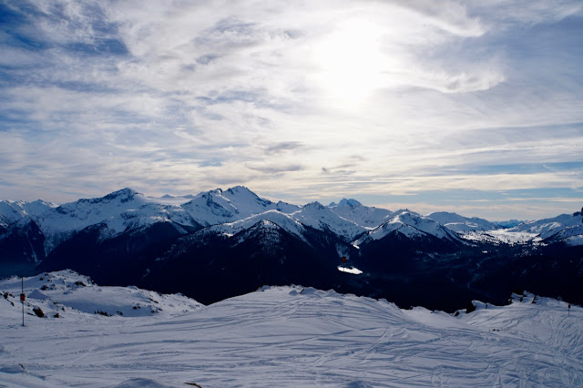
    Image from Friday.

    Ridge allowed some cloud into the area on Friday.


 Weather Observations for December 9, 2017 taken at 06:00 Hours.

2180 meters    +2, Winds were 25-35 KPH S  --Whistler Peak
1835 meters    +5, Winds were 15-25 KPH SE--Roundhouse
1660 meters    +1, 0 cm of new, 0 cm in 24 hrs  Base 141 cm --Pig Alley
  660 meters     -3, Valley Temp, Max Temp Yesterday was -0.2, 0.0 mm of precip recorded yest


FORECAST:

Ground Hog Day, the high amplitude ridge is still anchored over the west coast today with a Southwesterly flow aloft. A stratus deck is still over the valley with the low off the coast sending some high cloud our way again today. Some models are trending toward the high picking up anchor by Monday and slowly drifting away by Thursday of next week. A mix of sun and cloud for the next week with inverted temperatures and a high freezing levels. There is some talk about some flurries on Sunday, but unlikely.  A weak upper level trough is forecasted to push in with some precipitation and cooler temperatures by Thursday.. Enjoy the sun!!


    GOES IR from this am.

    Lows will send some cloud our way, still warm at 1850 meters.


     INFORMATION & OBSERVATIONS:

    Cool temperatures in the morning, nice to see the snow makers doing their magic.

    Many turns on Flute. Time for a new surface!!!

    Into the snow zone.

    Still ice in the valley creeks, negative temperatures all day on Friday.


                                   Come out and support CARDA.


ARTICLES:

Two climbers killed, seven missing in Southern Iran Avalanche: Oshtorankuh Mountain

Information on Oshtorankuh Mountain: Wikipedia

Backcountry recreation "skyrocketing" deaths aren't: Montana

Despite decades of backcountry experience, beloved coach died in avalanche: Alaska

For skiers its uphill all the way: New York Times

8 Dec 2017

December 8, 2017


    AVALANCHE ACTIVITY:

    Locally, still some snowballing and wet loose avalanches.

    An avalanche has killed a ski tourer in Slovakia, story in article section.

    YESTERDAY:

    Low level cloud flowing from the North.

    Another awesome day.

    Fog and stratus layer in Howe Sound and Vancouver.

    Just before sunset on Thursday.

Weather Observations for December 8, 2017 taken at 06:00 Hours.

2180 meters    +2, Winds were 25-35 KPH S  --Whistler Peak
1835 meters    +4, Winds were 10-20 KPH SE--Roundhouse
1660 meters      0, 0 cm of new, 0 cm in 24 hrs  Base 142 cm --Pig Alley
  660 meters     -3, Valley Temp, Max Temp Yesterday was +1.2, 0.0 mm of precip recorded yest

   As of 07:00 Hrs this am we have high broken cloud, unlimited visibility and valley cloud.


FORECAST:

The strong upper ridge will maintain dry and warm conditions into at least the end of next week. The low to the North will send some cloud into the area over the next few days with continued inverted temperatures. Today we will be in a moderate southwest flow aloft. Cold air will pool in the valleys. High yesterday of +11 at 1835 meters.


    GOES IR image, looks like the low will send some cloud our way.

    Low and high side by side. 850 mb equates to about the Roundhouse level.

    Stratus layer in the Strait of Georgia yesterday.

    Really big picture yesterday.

    INFORMATION & OBSERVATIONS:

    Dripping Cornices.

    Always pay attention to where you are leaving the ski area boundary.

    Warm temperatures can create Sz 1-Sz 2 wet loose slides.

    Snow making in the valley!! High of +1.2 and minimum of -3.6!!

ARTICLES:

A Sz 3 avalanche has killed a ski tourer in the Great Cold Valley: Slovakia

Daron Rohlves cautions youth about backcountry dangers: Vail Today

Avalanche awareness presentation comes to Library: Moab, Utah

Alaska reports extreme snowfall rates: 50.8 cm per hour

New lifts for Whistler Blackcomb: Powder Canada

7 Dec 2017

December 7, 2017


    AVALANCHE ACTIVITY:

    A bit more activity on Mount Currie!

    Locally, loose wet avalanches up to Sz 1.5. Lots of pinwheeling and snowballing.


    YESTERDAY:

    Clear skies except for some scattered valley cloud.

    Moon was very visible on Wednesday morning.


    High of +1.7 in the valley yesterday. +7 at 2240 meters.


Weather Observations for December 7, 2017 taken at 06:00 Hours.

2240 meters    +5, Winds were 5-10 KPH E  --Horstman Hut
1835 meters    +8, Winds were   0-5 KPH E  --Roundhouse
1660 meters    +1, 0 cm of new, 0 cm in 24 hrs  Base 145 cm --Pig Alley
  660 meters     -2, Valley Temp, Max Temp Yesterday was +1.7, 0.0 mm of precip recorded yest

    As of 07:30 hrs this am we have clear skies and unlimited visibility. Some valley cloud to the N.


FORECAST:

The strong ridge of high pressure will continue for at least one more week, models are indicating some unsettled weather beyond the next 7 days but that could change. High clouds from a system to the North will move into our zone Friday and Saturday for a mix of sun and cloud with the FL dropping to around 2400 meters. Cloud may linger on Sunday as well before the ridge strengthens and the FL begins to rise as high as 3700 meters on Monday.

    GOES IR image, high stretches down into Southern California.

    California!!!


     Warm temperatures in the alpine again for today.


   Ridge shifts East on Friday and Saturday but rebounds again on Sunday.


    INFORMATION & OBSERVATIONS:

    Melt freeze cycle on the rocks in the alpine.

    Blackcomb getting the alpine ready.


    Surface Hoar just below treeline. Patches of small surface hoar in the alpine as well.

    Moist surface hoar from sun exposure below 1000 Meters.

    Big picture on Wednesday.

    Surface hoar in the Callaghan.                                                                   Bridget Mcclarty Image


ARTICLES:

Early season avalanche on Mount Washington: New Hampshire

Use a Checklist to Facilitate Better Decisions: Mountain Skills

Richardson Rd closed following avalanches and extreme snow: Alaska

6 Dec 2017

December 6, 2017


    AVALANCHE ACTIVITY:

    Except for point releases on solar aspects not much happening in the corridor.

    Moist point releases on Mount Currie.


    YESTERDAY:

    Broken cloud over the valley early Monday morning.

    Cold temperatures in the valley. Minimum temperature yesterday was -6.3 Deg C.

    High pushed the clouds to the North.

    Clear to the Southwest.

    Great snow if you were willing to put some effort in getting to it.


Weather Observations for December 6, 2017 taken at 06:00 Hours.

2240 meters    +1, Winds were 5-10 KPH NNE --Horstman Hut
1835 meters      0, Winds were 5-10 KPH NNE  --Roundhouse
1660 meters     -2, 0 cm of new, 0 cm in 24 hrs  Base 148 cm --Pig Alley
  660 meters     -5, Valley Temp, Max Temp Yesterday was +1.7, 0.0 mm of precip recorded yest


FORECAST:

The strong upper ridge will continue to bring dry weather to the area for at least one week. Northerly flow aloft will continue with inverted temperatures and cold air trapped in the valley. The freezing level could easily reach 3500 meters by tomorrow.  A weak system out of the North may bring some cloud for Saturday, but the ridge rebounds on Sunday.


    GOES IR image from this am.

    Warm high pressure directly over us.


    Yesterday's image.


INFORMATION & OBSERVATIONS:

    Cold temperatures in the valley have helped with snow making.

    I believe this is a first for this route outside the boundary.

    Sun will affect the snow on many of the glaciers.

    Lost Lake is beginning to freeze.


    Observations from the Duffy from Jeff Van Driel.                                            Jeff Van Driel Image


Les and I had a great day on the Duffey today under broken skies in the morning, clear in the afternoon, light north winds, -2 degrees as a high and no precipitation. We skied between 1300m and 2400m and ski penetration averaged 20-30cm. 
Surface hoar was observed to be 5-10mm below treeline and at treeline and 2-3mm in sheltered terrain in the alpine. Previous light to moderate northerly winds have redistributed  surface snow and begun light reverse loading.
Steep solar aspects were affected immediately by the sun today as we observed mostly snowballing and moist snow as soon as the sun poked out at 11/1130. Most other aspects and lower angle solar terrain still hold cold, good quality snow. 
There was evidence of a cycle of north aspect slab avalanches in the alpine, 5-15cm deep, up to size 1.5. These slabs were specific to very steep, lee features, and isolated on steep, lee features, that appeared to be 48-72 hours old. 
There is a decent, well settled, base out there, but still be wary of early season hazards. 

Cheers
Jeff


     Looks like nice snow on the Duffy.                                                                                                   Leslie Manley Image


FROM South Coast Touring:


Sam Mcgrath
December 5 at 8:09pm
Hey Amigos! 
Quick trip report from Joffre lakes today. We stuck to North-ish aspects and kept out of the sun. Snow is well consolidated and firm but still pow. Rode fairly mellow alpine slopes and cut some steep rolls with no results. No significant wind affect. Conditions on sun affected slopes were as to be expected, we noticed multiple loose wet point releases mostly underneath rocky features nothing really exceeding size 1. 
Have fun be safe!


ARTICLES:

Experts to asses potential for increased avalanche risk: Waterton Lakes National Park

Important Voltair Avalanche Airbag Advisory: Arcteryx

The avalanche course that aims to save lives this year: Mountain Air