


Weather observations for March 28, 2014; taken at 06:00 hrs this am.
2240 meters -7, Winds were 20-40 KPH from the S
2180 meters -6, Winds were 40-55 KPH from the SSE
1860 meters -5, Winds were 10-25 KPH from the SSE
1835 meters -5, Winds were 20-40 KPH from the SSE
1650 meters -3, Trace of new snow, 1 cm in 24 hours, Base 266 cm
1550 meters -2, Trace of new snow, 1 cm in 24 hours, Base 210 cm
660 meters +1, Valley Temperature, Max temp yest +8
For the forecast, a large stationary surface low will send several troughs through our zone today into Sunday. The first trough is upon us with light to moderate snowfall expected soon, above 800 meters, unfortunately it is looking drier for Saturday/Sunday then previously forecasted. The next trough moves onshore Saturday night into Sunday. Unsettled weather is expected for Monday. Guesstimates: 10-15 cm by Saturday morning, 10-15 cm for Sunday morning, 3-5 cm by Monday morning.
Presently in the alpine we have broken skies, unlimited visibility and not snowing yet.
Avalanche activity in the corridor yesterday were mostly loose avalanches up to size 1.5, some loose point releases on solar aspects. It appears the Duffy area was the most active zone in the corridor.

.jpg)

Video Fridays:
10 Things You did not know about avalanches: BBC Documentry
Grizzly bear tries to eat Go Pro camera: Cool Video
NYC Freedom Tower B.A.S.E. Jump: Since its release they have been charged
Images of Whistler 1975: Whistler Museum
Drone footage inside an ice cave: Vimeo
Snow Talks, Avalanche Summary Forecast; March 27-29 2014: Calgary Outdoor Centre
FWT Xtreme Finals March 29, 2014, old teaser: Verbier
Articles:
Avalanches hit Road Sixty One: Iceland
Can ACL Surgeries be Avoided: Health Day
The Death of a guide who fell into a crevasse, crazy story: Pistehors.com
Conditions Outlook, March 22-29, 2014 : CAC Forecasters Blog
Safely Exploring the Backcountry: Alpine Initiatives
Update on the avalanche in the Adamants: Revelstoke Current
Wayne,
Some potentially useful beta for just south of Whistler.https://lh3.googleusercontent.com/-6zL3toU4ML8/UzER9VcQGHI/AAAAAAAAOEI/dARByaOYS1Y/s800/IMG_0538.jpg
https://lh6.googleusercontent.com/-6np7emYQqHU/UzESS1MhjVI/AAAAAAAAOHA/2w1yj8O7gUs/s800/IMG_0583.jpg
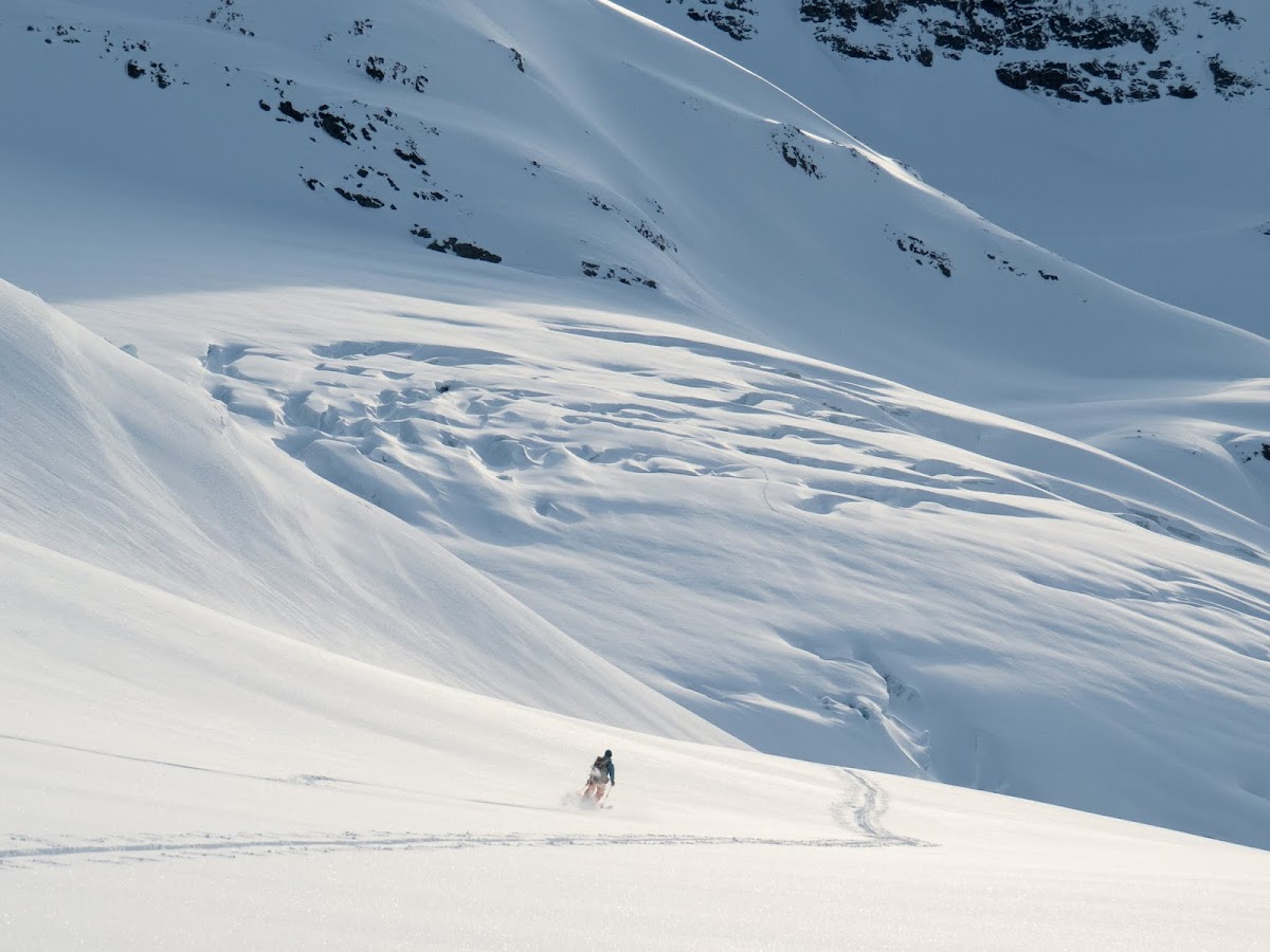
Check out the route through the Sphinx Glacier (that route ascends up the east side of Deception) in the background of this photo:
https://lh5.googleusercontent.com/-_NK3tMHkSIc/UzESkZ3S4gI/AAAAAAAAOJo/IOYTWOR5pbw/s1200/IMG_0634.jpg
https://lh5.googleusercontent.com/-_NK3tMHkSIc/UzESkZ3S4gI/AAAAAAAAOJo/IOYTWOR5pbw/s1200/IMG_0634.jpg
(need to zoom)
The barrier is kind of in (a little bit of alder poking through near the ramp)
other images https://picasaweb.google.com/112349006697496513121/DeceptiveBookworms?authuser=0&feat=directlink
other images https://picasaweb.google.com/112349006697496513121/DeceptiveBookworms?authuser=0&feat=directlink
lots of cool ice features
Alex Gibbs


No comments:
Post a Comment