Early morning light Friday March 18, 2016. Cirrus clouds slowly moved in during the day.
Cornices are huge. North of Whistler.
This cornice release occurred between Thursday night and Friday morning.
Ran a fair distance.
Sloughing Friday afternoon on steep slopes, Sc.
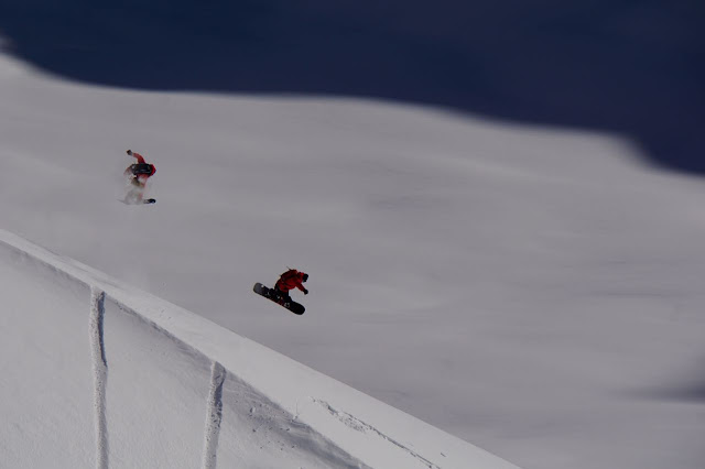
Wind lip shenanigans.
Sending it.
Cloud did move into the area Friday morning.
Did see a slab release from a cornice drop.
Weather Observations for March 19, 2016: taken at 06:00 Hours.
2240 meters -2, Winds were 10-20 KPH SE --Horstman Hut Station
2180 meters -5, Winds were 20-25 KPH SSE --Whistler Peak
1860 meters -1, Winds were 10-15 KPH SSE --Rendevous
1835 meters -1, Winds were 5-10 KPH WSW --Roundhouse
1650 meters -3, 0 cm of new snow, 0 cm in 24 hrs, 340 cm Base, RH 80% --Pig Alley
1550 meters -2, 0 cm of new snow, 0 cm in 24 hrs, 266 cm Base, RH 86% --Catskinner
660 meters 0, Valley Temp, Max Temp Yesterday was +9.7. 0.0 mm of Precip recorded yest
As of 07:00 Hours this am we have broken cloud and unlimited visibility.
For the forecast, a weak front will bring isolated intermittent showers to the area today as it moves Eastward and becomes unsettled later today, with a FL maxing out at around 2000 meters by this afternoon. A moist front will move onshore for Sunday with moderate precipitation expected with the FL hovering near the 2000 meter level Sunday morning, dropping to around 1500 meters later in the day in a strong SW flow aloft. A cold front will bring some snow to the upper elevations later on Sunday evening into Monday morning. An upper low will bring unsettled weather to our zone for Monday into Tuesday with some snow flurries in the upper elevations, the FL will fluctuate from 1400-1800 meters. As of now it looks like another weak front will move in for Wednesday. Stay tuned. Guesstimates: 15-20 cm by Monday morning above 1500 meters.
Cloudy and fairly dry for today with some intermittent showers expected.
Wave of precipitation is weakening as it moves on shore.
Front for Sunday.
Unsettled Monday into Tuesday.
ARTICLES:
How long could the local ski hills stay open: Vancouver
Joe Denney talks about avalanche that killed his friend: Mountain Sledder
Caught in an avalanche while sledding near Golden: A very Lucky Doug Lakeman
Air time.
Snow quality on Friday was still very good.
More huge cornices. Some will become very unstable with the rising FL.
Clouds became thicker as the day progressed.


No comments:
Post a Comment