Avalanche Activity:
Xe JC wall 30-60 cm soft slab avalanches Thursday morning.
Avalanche control yesterday produced Sz 1-1.5 VSSL avalanches below 1900 meters with several 1-2 SSL above 1900 meters. Xl, XE, SC, 20-80 cm. Size 2 up to 80 cm SSL in the Upper Lillooet River. Would be good to let the 1 meter + of new snow some time to settle.
Rendevous Deck.
Some wallowing going on Thursday.
Cool cornice development at 1835 meters.
13 cm in 5 hours at 1550 meters Thursday at 11:30 Hrs, 25 cm by 14:30 Hrs at 1550 meters..
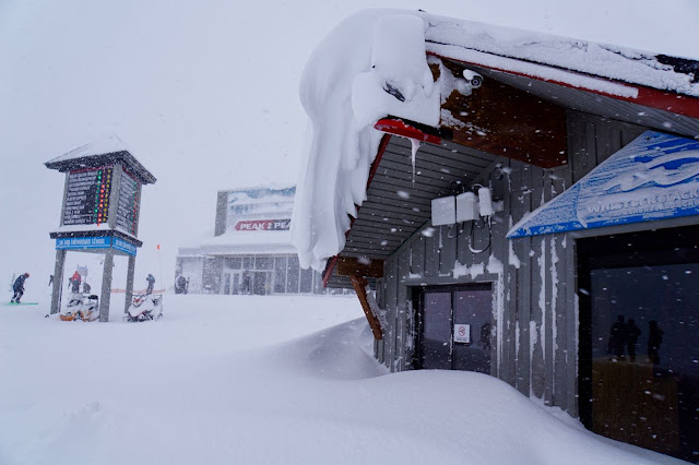
Image from Thursday morning.
Weather Observations for November 25, 2016: taken at 06:00 Hours.
2240 meters -7, Winds were 15-25 KPH S --Horstman Hut Station
2180 meters -7, Winds were 25-35 KPH S --Whistler Peak
1860 meters -6, Winds were 10-20 KPH SE --Rendevous
1835 meters -5, Winds were 15-30 KPH S --Roundhouse
1650 meters -5, 35 cm of new snow, 65 cm in 24 hrs, 192 cm Base, RH 98% --Pig Alley
1550 meters -5, 33 cm of new snow, 59 cm in 24 hrs, 128 cm Base --Catskinner
660 meters +1, Valley Temp, Max Temp Yesterday was +1.7. 23.5 mm of Precip recorded yest
Will update amounts as soon as the patrol has the data.
As of 07:00 hrs this am we have broken cloud and variable visibility.
For the forecast:
The weakening low will send an upper level trough for this morning, it will be somewhat stable this morning (unsettled) with another warm frontal band expected tonight in a Southerly Flow. The front approaching tonight has the potential to just be South of our zone, only time will tell. A bit warmer than forecasted, with the FL fluctuating from 800 m to 1200 m in the next few days. Moderate snow is forecasted for Saturday with a short lived break in the evening. Sunday morning may also be unsettled before another impulse of precipitation pushes through in the afternoon/evening with periods of moderate snow fall. A very weak ridge may build for Monday with unsettled conditions for most of the day. Guesstimates: 10-15 cm by Saturday morning, 20-30 cm by Sunday morning, 10-15 cm by Monday morning. These amounts will likely be adusted tomorrow.
Light flurries this morning with another impulse tonight.
Unstable this evening.
Some breaks for Monday.
VIDEO FRIDAY:
5 Rules for Skiing in the Backcountry: Greg Hill
Don't get caught in an avalanche: Know Before You Go
ARTICLES:
Ride Whistler Ride Report: Mountain Sledder
Stevens Pass Ski Patrol Resource: Patrol Blog
Min to Win: Avalanche Canada
Skinning Technique: Backcountry Skiing
Lots of fun Thursday.
At times we had some snowy moments.
As of 14:30 Hrs Thursday--30 cm in 8 Hrs-70 cm in 16 Hrs-100 cm in 48 Hrs at Pig Alley.
Snowed on Snow Guns.


No comments:
Post a Comment