21 Nov 2015

November 21, 2015

    Rumbling Glacier before Sunrise Friday November 20, 2015.

    Some keener's were lined up at 08:00 Hours Friday.

    Satellite image early Friday afternoon.

    There is some moisture out in the Pacific. Anyone know what those lines are?

    Another amazing day on Whistler Friday.

Weather Observations for November 21, 2015: taken at 06:00 Hours.

2240 meters      -7, Winds were 10-20 KPH SW  --Horstman Hut Station
2180 meters      -3, Winds were 15-20 KPH SSE  --Whistler Peak
1860 meters       0, Winds were 10-20 KPH NNE  --Rendevous
1835 meters      -1, Winds were 5-10 KPH E  --Roundhouse
1650 meters      -3, 0 cm of new, 76 cm Base, Relative Humidity 58%  --Pig Alley
1550 meters      -1, ? cm of new, ? cm Base  --Catskinner 
  660 meters      -7, Valley Temp, Max Temp Yesterday was +1.3.

    As of 07:00 Hours we have some high cirrus to the North with unlimited visibility.


For the forecast, ridge of high pressure over the Pacific Northwest will remain for another day with a warm offshore flow. Cirrus cloud will begin to move into the area this morning with cloudy conditions by this evening. The freezing level is still expected to spike well above the local peaks this evening. Sunday will be cloudy with some light rain in the morning changing to snow flurries later in the day in a Westerly flow. The freezing level will hopefully drop back down to 1000 meters by Sunday evening before a cold front pushes through on Monday with the FL dropping back to the valley by Monday evening. Tuesday is looking unsettled as a modified arctic front passes by our zone with the FL plummeting well below valley elevation bringing sunny conditions for Wednesday. Will guess on snow amounts for Monday in tomorrows post.


    Saturday morning, high scattered cirrus clouds.

    Looking like another nice day.


     Warmer temperatures today into Sunday.

    Low will send precipitation to the area Sunday into Monday.


ARTICLES:

B.C. Ski Resorts promoting Avalanche Education: Globe & Mail

The Human Factor 2.0: Doug Chabot & Karl Birkeland

Squaw unveils new Avalanche Control Technology: Gazex

Formation of Surface Hoar: NASA
Looks like good surface hoar weather next week.


    Snowmaking is slowly working there way to the valley.

    Frozen ponds on Whistler Golf Course Friday morning, -6 at 660 meters.

    Should look much different in one week with the temperatures we are expecting next week.

    Snow guns in action on Friday.

    Some cloud by days end Friday.

20 Nov 2015

November 20, 2015


    Image of Avalanche in Boundary Bowl from November 17Th.                            Adrian Bolden Pic


Top wind loaded storm snow and rain crust failed in boundary bowl.
Dug a hasty on similar terrain and the top 20cm of windload and slab popped while cutting the block. We chose not to ski the steeper line that had slid (not knowing it had slid until we viewed from the bottom) and shot the lower angle center of Boundary Bowl with no resulting excitement.
Will be interesting to see if this crust comes back to haunt us all season.
-Adrian Bolden

    Line up was to Zog's by 08:00 Hours Thursday, November 19, 2015. Snowmaking close to valley.

    Opening day always draws an enthusiastic crowd of slidders.

    Rainbow at sunrise yesterday morning.

    Awesome weather for opening day.

    Just before sunset Thursday.

Weather Observations for November 20, 2015: taken at 06:00 Hours.

2240 meters    -13, Winds were 20-30 KPH NNE  --Horstman Hut Station
2180 meters    -12, Winds were 25-30 KPH SSW  --Whistler Peak
1860 meters      -8, Winds were 10-15 KPH NNW  --Rendevous
1835 meters      -8, Winds were 5-10 KPH NE  --Roundhouse
1650 meters      -9, 0 cm of new, 76 cm Base, Relative Humidity 60%  --Pig Alley
1550 meters      -7, ? cm of new, ? cm Base  --Catskinner 
  660 meters      -8, Valley Temp, Max Temp Yesterday was +1.7.

    As of 07:00 Hours we have clear skies and unlimited visibility.


For the forecast, a surface ridge will build today into Saturday with clear sunny skies. A dry North-Northeast offshore flow will bring the Freezing level up to 1200 meters later today. FL on Saturday will rise above the local peaks by the evening. A weak front should bring cloudy conditions for Sunday into Monday before a deep upper level low moves onshore.


    High pressure for today.


    Surface Ridge for the next 2 days.

    Precip Monday and Tuesday.


Video Friday;

Know Before You Go: Awesome Production

Trigger Point Avalanche conditions: MountainSledder


Articles:

New snow means Avalanche Season has arrived: Avalanche Canada

How to tame your Avalanche Dragons: Mountains of Growth

Drones being banned from Ski Resorts across North America: California

AvaTech launches crowd sourced AvaNet: EarnYourTurns

Understanding the Extended Column Test: BackcountryMagazine


        Thanks to Anton for sharing this profile from Whistler Roll. Photos below:

                      SH 140 cm Whistler Roll                                           Anton Horvath Image

    SH 3-5 mm 15-11-11  Whistler Roll                                                                Anton Horvath Image

    Seemed like a happy crowd early Thursday morning.

    Making snow mid mountain on Whistler.

    Mount Garibaldi Thursday afternoon.

19 Nov 2015

November 19, 2015


    Size 2 natural avalanche NW Aspect Black Tusk Area Wednesday.                                      Jia Pic
    Thanks to Dary Hemmons for the intel:100 cm + crown Na during Nov 17 storm, ran in lower
    density 1F pp 1.5-2 mm that fell early in the storm. Wind loading to 120 cm lee N asp @ 1930
    meters, isolated cross loaded pockets.

                Na's Lesser Flute, photo taken Nov 18 Th-slid Nov 17 Th.  Anton Horvath Pic


    Sunrise Wednesday November 18, 2015.

    Snow making still working hard.

    First in line Wednesday at Noon.

    Yesterdays big picture.

    Ariel view of Horstman Glacier, looking better than last year at this time.


Weather Observations for November 19, 2015: taken at 06:00 Hours.

2240 meters    -12, Winds were 20-35 KPH NNE  --Horstman Hut Station
2180 meters    -11, Winds were 15-25 KPH SW  --Whistler Peak
1860 meters    -10, Winds were 10-15 KPH NW  --Rendevous
1835 meters    -10, Winds were 5-10 KPH N  --Roundhouse
1650 meters    -10, 0 cm of new, 77 cm Base  --Pig Alley
1550 meters      -9, 0 cm of new, ? cm Base RH 90 % --Catskinner 
  660 meters      -4, Valley Temp, Max Temp Yesterday was +2.4.

   As of 07:00 Hours this am we have clear skies, some broken valley cloud and unlimited visibility.


For the forecast, clearing trend with a Northwest Flow aloft will bring sunny weather as an upper level ridge builds into the weekend. A significant upper level trough should bring some snow to the area by Monday into Wednesday. Updates daily on that possible scenario. Freezing levels will hover in the valley for today, rising to around 1000 meters by Friday. Looking like there will be a spike in the FL Saturday evening, possibly rising higher than the local peaks. Inversions likely for the weekend.

    Clearing out this am, still some moisture to our South


    Some clouds this morning before surface high pressure builds.

    Looking Bluebird later this morning.

     East to Northeast offshore flow with warmer temperatures on Friday in the upper elevations .


ARTICLES:

Avalanche Canada urges patience for Backcountry travel: Pique

An effort towards Zero Avalanche Deaths: Project Zero

New Research project at Montana State University: Travel Behaviour in Avalanche Terrain

Highland Bowl Avalanche set off by Bootpackers: Aspen, Colorado

After 7 months, Avalanche Victims remains still being discovered in Nepal: Kathmandu


                   Na from Wednesday's storm, Back Bowl.                          Anton Horvath Pic

       Wind affected frozen shmoo on Black Tusk Wednesday.                   Dary Hemmons Photo

    More cloud than sun yesterday.


    Another ariel shot from yesterday morning. Decent coverage!!                                                  

    How many lights can you put on a tree??

18 Nov 2015

November 18, 2015


    Tuesday Nov 17, 2015. Heavy snow creating avalanche activity in many start zones. Whistler

    Thanks to Tristen Rasmussen for this photo, Hop Peak Avalanche. Information in articles below.

    Monday afternoon on Blackcomb Mountain at 1860 meters. -7, 60 KPH Winds--Felt like winter.

    New look for the Rendezvous.

    Tuesday November 17, 2015--08:30 Hours--Wet Snow, Blowing 40-80 KPH SSE, 0 Degrees.

    Satellite image Tuesday morning.

   Wet snow and winds at 13:00 Hrs 1835 M, Winds were gusting up to 145 KPH from 11-13:00 Hr.

    Big picture on Tuesday, began to dry out at around 15:00 Hours.

    By 16:30 hrs Tuesday clouds began to dissipate. Temperature at 1835 meters was -5.


Weather Observations for November 18, 2015: taken at 06:00 Hours.

2240 meters     No Data  --Horstman Hut Station
2180 meters     No Data  --Whistler Peak
1860 meters     No Data  --Rendevous
1835 meters     No Data  --Roundhouse
1650 meters    18 cm in 32 hours, 86 ? cm Base, Relative Humidity ?  --Pig Alley
1550 meters     No Data  --Catskinner 
  660 meters      -2, Valley Temp, Max Temp Yesterday was +6.9. 28.2 mm of precip.

Major wind event yesterday morning into the afternoon. These values were taken from 2240 meters. From 05:00 Hours Tuesday morning winds were 65-180 kph. 100-140 kph for a four hour period. Last gust just before the front passed was 179.9 KPH--(?) from the WSW at 14:30 Hours. Temperature at 11:00 hours had risen to -1 which dropped to -.03 at 12:00 Hours than back to -1 by 13:00 Hours . The FL dropped quickly in the wake of the front, light precipitation and clouds prevailed for the rest of the afternoon. By 15:30 hours it was -4 at 2240 meters. -10 at 20:45 hours then there seems to be a glitch in recording values from the various stations.

   As of 07:00 Hours this am it is cold, with broken cloud and unlimited visibility.

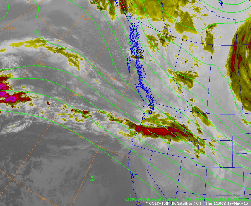
    Satellite image from this am.

For the forecast, unsettled conditions for today in a cool moist Northwest flow. A mix of sun and cloud with the slight chance of some isolated snow flurries.  Freezing levels for Wednesday into Thursday should hover near the valley bottom.  Northerly off shore flow will develop Thursday into Friday as a high pressure develops, bringing sunny conditions into the weekend.  Freezing levels appear to rise on Friday through the weekend reaching 2000 meters by Saturday afternoon. More on that in Thursdays Post. Once the mountains begin a daily routine, will be posting daily.  Looking like a nice day for the beginning of the 2015-16 Season.


    Northwesterly flow for the next few days.


    Unsettled for today, improving as the day progresses.

    Clearing Thursday,

    Looking nice on Friday.

    Clear Saturday into Sunday. RRR (Ridiculously Resilient Ridge) once again!!

    Next front should arrive Monday into Tuesday.

    Intense low that was upon us on Tuesday.


ARTICLES:

Information on the Hop Peak Avalanche, Brew Lake Area: Avalanche Canada

The Best Avalanche Beacon Review: OutdoorGearLab

North Cascades Highway closed for the winter: Washington State

10 Mistakes of the Backcountry Ski Touring Beginner: Backcountry.com

Avalanche burial of a snowmobiler in Alaska last weekend: SnowBrains
Survived after 25 minute burial.


    Good quality snow Monday.

    Snow in the valley Monday November 17, 2015. Photo taken at 17:00 Hours.

    Looking a lot like winter. 3.9 mm recorded at 660 meters on Monday.

    Very wet Tuesday morning into the afternoon. 28.2 mm of precipitation recorded at 660 meters.

    Fresh snow and rain produced a slurry.


    Raining hard just before the storm began to break. Tuesday afternoon 14:30.