23 Nov 2016

NOVEMBER 23, 2016


AVALANCHE ACTIVITY:

    Evidence of a sluff in Couloir Extreme on Blackcomb Monday.

Avalanche control on Whistler Mountain Tuesday produced one Sz 2 slab from a cornice drop, 100 cm crown running on 16-11-12 crust. Several other Xc with cornice debris.


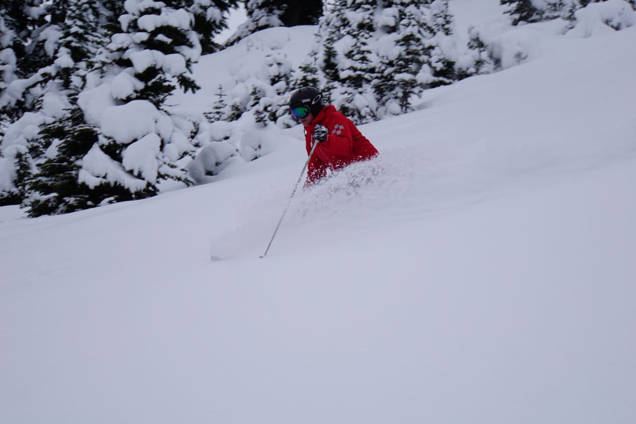
                                              OPENING DAY 2016-2017 SEASON

    Whistler Mountain opens today--Bring on the POW!!!


WEATHER MONDAY AND TUESDAY:

    First turns of the year Monday November 21, 2016.

    Snow conditions at 1700 meters are excellent.

    A few breaks in the weather Monday.

    Image from Monday.


    Tuesday November 22, 2016--Snowed all day with 26 cm recorded at Pig Alley.

    Snow skiing well to 1500 meters.


    Tuesday morning image.

    Camp out in town centre Tuesday evening.


Weather Observations for November 23, 2016: taken at 07:00 Hours.

2180 meters   -6, Winds were 35-55 KPH S --Whistler Peak
1835 meters   -4, Winds were 10-35 KPH S --Roundhouse
1650 meters   -3, RH 95%  25 cm of new, 37 cm in 24 Hrs, Base 126 cm Base  --Pig Alley 
  660 meters    0, Valley Temp, Max Temp Yesterday was +0.7, 15.1 mm of precip recorded yest

    As of 07:00 Hrs this am we have broken cloud with variable visibility.


FORECAST:

A frontal band went through the area early this morning with some light snow showers expected for most of today before the next vigorous frontal band brings moderate/heavy snowfall tonight into Thursday. We should see the winds ramp up this afternoon with a slow increase in precipitation as a deepening low off the coast sends a series of cool moist frontal bands our way into the weekend. The FL should hover in the 1000 m range, dropping to the valley by Friday. An upper trough will likely form for Saturday with some unsettled weather into Monday. In the meantime we can expect a further accumulation of 80-100 cm by Saturday morning. Thursday is looking like a storm day with high winds and heavy snowfall!!!


    Next frontal band in a Westerly flow arriving this evening. Strong winds and heavy snowfall.

    Deep low sending a cool moist front our way for Thursday.


    Sunday into Monday at this time could bring some sunny breaks.


SNOW OBSERVATIONS:

Dave Sarkany Nov 21, 2016
I went for a ski up Metal Dome today with Bridget Mc
Most vehicles made it up to the cabin near the end of the road at 1300m. We put our skis on 100m past the cabin. Later at the end of the day we managed to ski down to 1430m before the descending conditions became too boney.
The meadows are well covered but rocks and creeks are still prominent.
We dug a quick pit at around 1900m on an east aspect. Slightly cross loaded location.
We found an HS of125cm with 50cm HST above a solid crust at 70cm (above ground). Below 30cm( and to ground) most grains where still wet/moist
The recent (50cm) storm snow varied from 1F-4F density and presented easy to moderate sudden planar compression test results, but did not fail on the crust.
On our ski down we met two skiers who mentioned remotely triggering a Sz 1.5 slab near the summit.
Ski quality was best described as heavy! But it was the first ski trip of the year for me and the sun did shine for about 2 minutes :)

    Metal Dome                                                                                                    Dave Sarkany Image


ARTICLES:

Avalanche Danger closes North Cascades Hwy for the winter: Bellingham Herald

Cold Sweat--Behind the scenes with a Snowmaker: Mountain Life


    Monday morning.


    Looking like winter has arrived.

    Buried winch cat Monday afternoon.

    Getting ready Tuesday afternoon.

    Snowing in the village Tuesday evening.

    Keen young locals first in line and staying dry!!

21 Nov 2016

November 21, 2016

No recent avalanche information for this post.

WEATHER IN THE PAST FEW DAYS:

    Friday afternoon, November 18, 2016.

    Making snow to Mid Mountain.

    Image from Friday morning.

    Snowing in the valley Saturday November 19, 2016.


    Image from Saturday morning.

    Fairly cloudy in the morning. -1 at around 11:00 Hrs at 1835 meters.

    A bit of blue around 13:00 Hrs Saturday. Some breaks from noon to about 15:00 Hrs.

    Early Sunday morning November 20, 2016 -1 and snowing lightly.

    Sunday morning, looks unsettled!!

    A break in the precip Sunday.


Weather Observations for November 21, 2016: taken at 07:00 Hours.

2240 meters   -4, Winds were 10-20 KPH SE --Horstman Hut
1860 meters   -2, Winds were 10-20 KPH SE --Rendevous
1650 meters    0, RH 94%  2.8 mm of precip  --Pig Alley  Precip from 16:00 Hrs yest
  660 meters  +5, Valley Temp, Max Temp Yesterday was +3.6, 7.6 mm of precip recorded yest


    As of 08:30 Hrs this am we have overcast skies, variable visibility and it is snowing lightly.


FOR THE FORECAST:

A series of cool Pacific storms will move through the area all week. Expect mostly cloudy skies today with some light precipitation and a chance of some breaks later in the day. Today will be the warmest day of the week with a descending FL by tonight. Another weak front arrives Tuesday with some decent precipitation in the evening with the FL hovering in the 1000 M range. We should see a West South West flow for Monday into Tuesday. A more Westerly flow for Wednesday, light/moderate snow can be expected just above the valley floor as the jet stream remains over Northern California with several more colder fronts heading our way for later in the week. Bring on the powder!!!!  Regular posts begin on Wednesday. Depending on the models, we could easily receive from 50 to 1.25 meters of snow by Friday evening with this parade of frontal bands.


    Weak front today with a break later on in the day.


    Flow for Monday.


    Most snow falling Monday night.

    Tuesday into Wednesday, looks like some good snowfall Tuesday into Wednesday.


   Another front for Wednesday. Wednesday night has the potential for 30 cm.

    Juicier front for Thursday into Friday.

    Long range model shows another front for Friday with some weak ridging by the weekend..


OBSERVATIONS:
  

From Eric Carter November 20, 2016


Drove up to the Cabin on Metal Dome this afternoon. Lots of people up there today. Snow on the road and skins on at the car (rock ski conditions on the road). Snow line was just below the cabin when I left with heavy wet snow falling fast. A lot of heavy accumulation from 1500 and up in the area (Whistler reporting 12cm in the last 24hr). Was quite windy with vis <20m above treeline. Didn't seem like a good day to be a snowboarder.


ARTICLES:

Min to Win: Avalanche Canada

Upcoming Avalanche Awareness Events: Avalanche Canada

When a snow avalanche hits a body of water: Journal of Geophysical Research

Latest ENSO report, Nov 14, 2016: NOAA

Three Month Outlook: NOAA


    Whistler Bowl Friday.

    Snow line is looking respectable.

    Mt Currie Friday afternoon.

    Wedge Saturday afternoon. 1.1 mm recorded at 660 m.

    Blackcomb just before dusk, it began precipitating again Saturday night.

    Nesters weather station Sunday, 7.6 mm recorded.

    Awesome event at Forlise last night for the Sperahead Huts.


              We must be the only Western Ski Resort that does not have one of these sessions!!

18 Nov 2016

November 18, 2016


AVALANCHE ACTIVITY:

    Large slab avalanche in Tignes set off by Ski Patrol, article below.                    Tignes Pistehors Pic


WEATHER IN THE PAST FEW DAYS:

    Monday morning.

   14 cm of new snow on 60 cm firm base at 1860 m on Monday.

    Image from Monday morning.


    Early Tuesday morning, November 15, 2016 -3 at 1835 meters, nice to see the snow guns working!

    Image from Tuesday morning.


    Snow line came close to the valley bottom early Tuesday morning.

    Wednesday November 16, 2016  -6, light wind--great snow making weather!!!

    Image from Wednesday morning!!

    Snow guns were pumping at mid mountain on Wednesday.


    Thursday morning November 17, 2016  -5 and the guns are producing!!

    Thursday's image.

    Snow line Thursday at noon.

Weather Observations for November 18, 2016: taken at 07:00 Hours.

2240 meters   -9, Winds were 15-30 KPH ESE --Horstman Hut
1860 meters   -7, Winds were   5-10 KPH ENE --Rendevous
1650 meters   -5, RH 100%  0.0 mm of precip  --Pig Alley  Precip from 14:00 Hrs yest
  660 meters    0, Valley Temp, Max Temp Yesterday was +4.8, 1.0 mm of precip recorded yest

We could easily receive between 20-40 cm of snow at 1500 meters by Tuesday evening with the FL fluctuating from a high of 1600 m (Sunday) to a low of 700 m (Today). Cooler more seasonable temperatures should arrive by Wednesday in a Westerly flow aloft.


    As of 07:30 this am we have obscured conditions at 1835 meters.

    High thin overcast with low valley cloud at 2135 meters.

WHISTLER IS OPENING WEDNESDAY NOVEMBER 23, 2016. :)

FOR THE FORECAST:

A brief weak  upper level ridge will bring clear conditions to the alpine this morning before another dry air mass with cloudy conditions moves onto the coast with a  weak frontal band expected by early Saturday morning in a Southerly flow aloft. Low level cloud will likely remain in the valley with an offshore low level flow.(some breaks) We are between the high and low.  Saturday should bring some very light precipitation with overcast conditions with a rising FL by the evening. There is a chance of some breaks Saturday afternoon.  The onshore Southerly flow will continue into Sunday with the FL hovering in the 1500 meter range with light/moderate precipitation. Models differ for Monday, we may see some breaks but likely to continue with light precipitation and a descending FL by Monday evening. Another frontal band for Tuesday with light  to moderate precipitation and cooler temperatures as the flow switches to Westerly by Wednesday. Will start posting daily as soon as the mountain opens. Hopefully with a clearer picture and accurate snowfall amounts on a daily basis!! More info on Monday!!


   Unsettled this morning with some cloud from the low moving onshore by the afternoon.


    Large low off the coast, weak high to the Southeast, low will eventually win with more cloud.


    Low off the coast with a Southerly flow aloft.

   Front heading our way early Saturday morning. should see lots of cloud from the low.


   Weak front on Saturday with the chance of some breaks in the afternoon.

    Sunday with a lull on Monday later in the day. More precipitation as the low starts heading NE.

   More snow and Westerly flow for Wednesday.

    Long range into Friday, looks pretty decent, cooler temperatures and snow in the forecast.


VIDEO FRIDAY:

Canada's Worst Avalanche Disaster: Rogers Pass

Shades of Winter:Between--Trailer

The Snow Guardian: billy barr


ARTICLES:

Huge windslab avalanche triggered by Tignes Ski Patrol: France

French maps to show 30 Deg slopes: Pistehors.com

77 People killed by avalanches in the 15/16 season in the Alps: WePowder

Avalanches-From Cloud to Cloud: Konstanz University


OBSERVATIONS:

Thanks to Simon Thomson for the image and observations November 16, 2016:


Went out for a wander in Brandywine area today.  At 1750m, North aspect, we found a 200cm snowpack with 35cm of new sitting over a 15cm crust. All this overlying moist snow to ground.  Little to no wind affect felt in areas skied today.  Good skiing!  As seen in the profile photo attached, there's a huge contrast between the old and the new!

Simon


    The jet stream has migrated South bringing more seasonable temperatures in a Westerly Flow aloft.


    Roof avalanche on Monday.

    Monday just before sunset, 0.9 mm recorded at 660 m on Monday.

    Tuesday the snow line began its march back down the mountain.

    4.9 mm or precipitation recorded at 660 m on Tuesday.

    Unsettled Wednesday morning with showers, later in the day. "I Skied Fissile Like a Missile" PC

    1.5 mm recorded at 660 meters on Wednesday.

    Thursday morning the W/B weather machine producing cloud.

    1.0 mm recorded at 660 meters on Thursday.