10 Jan 2017

January 10, 2017


    AVALANCHE ACTIVITY:

    Sa Sz 1 soft slab partial burial on Surfs Up-Winky Pop , 30 cm slab  on Monday.

    Inversion and moist air mass Sunday night did not help with the snow quality in the alpine.

    Avalanche control on WB produced Sz 1-1.5 soft storm slabs Xe, Xl, Sc, Sa. A Sa Sz 1 was                 reported South of Whistler.


   YESTERDAY:

    Soft groomers. First lift, Monday January 9, 2017.

    There were nice turns to be had, 10-25 cm of low density snow depending on elevation & aspect.

    Overcast and very light snow early Monday morning.

    Rendevous Deck.

    Danger Scale sign at the blow hole.

    Crystal Zone..

    Monday Morning.
    Snowed more in the valley yesterday morning..

    25 cm on Lower Gear Jammer, while Lower Cruiser only had 15-20 cm.

    Clouds in the valley just before sunset.


WEATHER OBSERVATIONS:

Weather Observations for January 10, 2017: taken at 06:00 Hours.

2240 meters   -13, Winds were 25-35 KPH NNE--Horstman Hut 
2180 meters   -13, Winds were 20-35 KPH E     --Whistler Peak
1860 meters   -14, Winds were 10-20 KPH NE   --Rendevous
1835 meters   -14, Winds were  5-10 KPH ENE --Roundhouse
1650 meters   -13, 2 cm of new snow, 3 cm in 24 hrs, 189 cm Base, RH 93%  --Pig Alley
1550 meters   -14, 1 cm of new snow, 3 cm in 24 hrs, 110 cm Base, RH 90%  --Catskinner 
  660 meters     -9, Valley Temp, Max Temp Yesterday was -5.1, 5.1 mm of Precip recorded yest

-13 with a 30 KPH wins brings the windchill too -23. Cover up!!!


   As of 07:00 Hrs at 1860 M we have broken cloud and variable visibility-it is snowing lightly.


FORECAST:

Unsettled weather this morning with a few clouds remaining from the weak shortwave trough that is moving South. Clear skies by this afternoon as a  dry Northerly flow with cold temperatures and outflow winds will be with us until Friday. Several weak warm fronts will move onshore for Friday into the weekend. At this time Friday will likely be unsettled with increasing cloud as the day progresses. Saturday will be overcast with some very light snow, a stronger warm front arrives Sunday with moderate precipitation and warmer temperatures. The freezing level will begin to rise on Saturday into Sunday and could get as high as the weather plot at the bottom of Catskinner Chair. Stay warm, cold today.

    Missed us again!!


    Clouds will disperse and clear skies for today.

    Looking cold and dry for Wednesday.

    Thursday is also looking clear and dry.

    Frontal bands for the weekend, first one arrives on Friday.

    Snow Saturday into Sunday with seasonable temperatures..


ARTICLES:

The Science behind avalanches: Walking Mtn. Science Center

Avalanche Control on Mammot Moutain requires a big gun: 105 mm Howitzer

Avalanche Warning: Wyoming

After "Close Call" Saturday Aspen area Avalanche risk soars higher: CAIC

Crested Butte closed because of avalanche danger: Too Much Snow

Idaho 75 closed due to avalanche risk: 30 Mile Section

Avalanche up to 15 Feet deep closes I-70 in both directions: Vail Pass


    OBSERVATIONS:


    Graupel and stellar conglomerates in the valley Monday morning.

    Beacon Checker at the entrance into the Eastern section of Blackcomb Glacier.

    Purple Haze

    Nice snow in Feather Tree.

    Wind pressed on SE exposure Blackcomb Glacier, yesterday, some ribs skied well.

    A few breaks during the day.

    Not a lot of traffic into Spanky's.

9 Jan 2017

January 9, 2017


    AVALANCHE ACTIVITY:

    An avalanche in the Gemsstock area of Switzerland has claimed an off piste skier, story below.

    An avalanche in the Ovrannaz area of Switzerland has claimed a life, story below. Net Pic

    No avalanche activity reported locally.


    YESTERDAY:

    Some cloud early Sunday January 8, 2017.

    Very heavy tree bomb.

    Front slowly approached Whistler.


    Very light snowfall at 13:30 Hrs in the alpine.

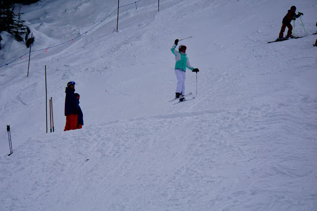
    Mogul Training.

    Snowing 1 cm per hour by 20:00 Hrs Sunday night.

   Satellite image Sunday morning.


    Looking North just as the front moved in.

    By 13:00 Hrs the snow flurries were close.

    Route Training.


WEATHER OBSERVATIONS:

Weather Observations for January 9, 2017: taken at 06:00 Hours.

2240 meters   -9, Winds were 25-60 KPH S   --Horstman Hut 
2180 meters   -8, Winds were 40-60 KPH S   --Whistler Peak
1860 meters   -7, Winds were 25-45 KPH SE --Rendevous
1835 meters   -6, Winds were 20-35 KPH SE --Roundhouse
1650 meters   -5, 15 cm of new snow, 15 cm in 24 hrs, 193 cm Base, RH 97%  --Pig Alley
1550 meters   -5, 12 cm of new snow, 12 cm in 24 hrs, 112 cm Base, RH 98%  --Catskinner 
  660 meters   -7, Valley Temp, Max Temp Yesterday was -4.6, 2.6 mm of Precip recorded yest


    As of 07:00 Hrs we have overcast skies limitedvisibility and it is snowing 1 cm per hr.


FORECAST:

Continued overcast conditions with light snowfall for today in a Southwest Flow. The snow will ease off later in the day with unsettled conditions tonight. The cold arctic high will bring clear skies for Tuesday into Thursday with a Northerly flow. A low pressure system will bring unsettled weather for Friday with moderating temperatures. By Saturday we will see a weak frontal band bring more snow to the area. Outflow winds for Tuesday-Thursday, bundle up. Guesstimates: 5-10 cm by Tuesday morning.

    Still the chance of some accumulation today.


   Precipitation until at least Monday night.

    Looking dry for Tuesday.


    Cold Arctic High easily pushes the low Southward.


    Dry and cold for Wednesday.


    Looking like a clear day for Thursday.


ARTICLES:

Two separate avalanches kill 2 in Swiss Alps: Switzerland

Individual articles below:

Skier killed in an avalanche in Tita Seri in Vallis: Switzerland

Avalanche kills off piste skier at Gemsstock: Switzerland

Spearhead Hut Project: Funding Opportunities

California braces for Flooding & Avalanches as Sierra gets slammed with snow & rain: Lake Tahoe

Avalanche risk could rise in Central Oregon: Wet on Dry


OBSERVATIONS:


January 8 at 7:56pm

Windy day on Fissile today. The bootpack is stripped down to scree with a few snow patches. There was about 5cm of wind loaded snow in Banana Chute on top of a firm crust. Sluff didn't run very far but it could become dicey with more new snow.


    Some cool clouds on Sunday.


    Front slowly took over Sunday afternoon.


    Enjoying some great off piste skiing.


    Steeps were busy on Sunday. Snow was smooth and grippe.


    Front was heading our way in the morning.