5 Dec 2017

December 5, 2017


    AVALANCHE ACTIVITY:

    Two ski tourers have been killed in an avalanche in France. Story below.                            Net Pic

    Sz 1 Sc in the Rainbow Area.


    YESTERDAY:

    Monday morning.

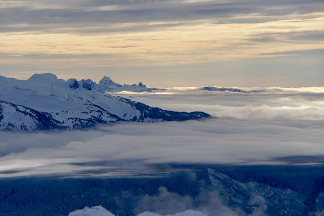
    Stratus layer.

    Multiple cloud layers throughout the day

    There were some patches of blue.

    Awesome light later in the day.


Weather Observations for December 5, 2017 taken at 06:00 Hours.

2180 meters    -2, Winds were ?                            --Whistler Peak
1835 meters    -1, Winds were   5-10 KPH WNW  --Roundhouse
1660 meters    -4, 0 cm of new, 0 cm in 24 hrs  Base 149 cm --Pig Alley
  660 meters    -5, Valley Temp, Max Temp Yesterday was -1.0, 0.0 mm of precip recorded yest

    As of 07:00 hrs this am we have broken cloud and unlimited visibility.


FORECAST:

The high pressure will strengthen today with dry and stable weather in a Northwesterly flow aloft. Sunny weather can be expected until Saturday when there is a possibility of some cloud, but for the long term the blocking pattern may stick around into next week. The freezing level today will rise to around 2200 meters with inverted temperatures. By Thursday the FL could go up as high as 3700 meters. Get out the sun screen!!!


    GOES IR this am.

    High strengthens today.

     Warmer temperatures by tomorrow.


    INFORMATION & OBSERVATIONS:

   Sz 1 slab from Monday.

    Cornice chunk, yes some are brittle.

    High and mid mountain cloud for most of the day Monday.

    Different perspective looking at the top of Blackcomb.

    Avalanche practice, important to keep skills up!!


Recent Avalanche Canada MIN reports:

Na off Skypilot: Dec 4Th


ARTICLES:

An avalanche has killed two ski tourers on Col de Lechaud: France

Another possible avalanche incident in France: Mount Dan-de-Krol

Snowmobilers cautioned to know avalanche safety before hitting trail: Whitecourt Star

Interesting facts about avalanches: Questions & Answers

4 Dec 2017

December 4, 2017


    AVALANCHE ACTIVITY:

    Sz 1 yesterday on steep convex roll in the Pemberton area.


    YESTERDAY:

    Just before sunrise on Sunday morning.

    There were some clouds around Sunday morning.

    Clouds dissipated by the early afternoon.

    Looking up into the Pemberton Meadows.

    Bluebird eventually.

    Nice light on Wedge just before dusk.

    Nice looking sky at sunset.


Weather Observations for December 4, 2017 taken at 06:00 Hours.

2180 meters    -10, Winds were 10-20 KPH WNW --Whistler Peak
1835 meters    -10, Winds were   5-10 KPH ESE  --Roundhouse
1660 meters      -9, 0 cm of new, 0 cm in 24 hrs  Base 153 cm --Pig Alley
  660 meters      -5, Valley Temp, Max Temp Yesterday was -0.5, 0.0 mm of precip recorded yest


FORECAST:

The upper level ridge will continue to build this week with dry and stable weather in a Northwesterly flow aloft. The blocking ridge will also bring in some warm air from the south by Tuesday with the Freezing Level rising to 3500+ meters by Thursday. For today we will see the FL possibly rising to surface with some cloud in the area dissipating by this evening.  No real change expected for the next week. Expect sunny conditions from Tuesday thru Friday.


    GOES IR image from this am. Clouds in the area!!

    High pressure still building.


INFORMATION & OBSERVATIONS:

    Finding the November 23 & November 26 crust.


    Nice skiing on Sunday.

    Another awesome day.

    Sunday afternoon.

    High building on Sunday.

From South Coast Touring:

   
Matt Gunn
December 3 at 9:58pm
Excellent conditions in the Whistler backcountry. Lots of folks out in the musical bumps. Good quality snow in protected areas and open forest. On more exposed slopes it was possible to hit the pineapple express crust on some turns. Crust was very evident in thick trees. Saw only one sign of instability, a small slab had cut out at the prominent convex roll on flute above oboe creek but did not propagate very far. Beautiful day.


Jim Morrison
December 3 at 5:53pm
Same old story on North Side of Mt Sproatt: over 15 snowmobiles were shredding every line in the prohibited area. Managed to tell 3 of them they were in the watershed area and they should get out of there just to be ignored. Did not manage to get any clear picture of the license plates, unfortunately. For reference here is the maps that show very clear the north side and valley below Sproatt to be prohibited to mechanised access. Thankfully after 45 min they left us alone to enjoy some amazing POW and quietness.


Matt Gunn
December 3 at 11:35pm
CONTEST! The Escape Route Adventure Demo Centre has offered a huge prize to South Coast Touring, a pair of Tour One DPS Skis - 99, 106 or 112 width ($1,100 value). What's the Adventure Demo Centre you ask? 

"The new Escape Route Adventure Demo Centre is a hub for alpine adventurers. We are the largest provider of backcountry rental gear in Whistler. Backcountry skis, splitboards, snowshoes and avalanche safety gear, we have it all. This is all available at our centre located at 4433 Sundial place in the Saint Andrew’s building. We are less than a 2 minute walk from the lifts and are between the Keg and Fanatyco. Come in and see us for your back country rental needs or to talk about and demo one of our special brands, DPS, Karakoram, Dynafit or Spline splitboards. 
Plan your trip in advance, all items can be reserved and booked on line. See the rental tab on our website,  www.escaperoute.ca". 

To enter the contest post ONE photo of heading uphill while backcountry touring in the Whistler area. The contest will run from today until Friday, December 15 at which time a winner will be randomly selected. Keep tabs on this post - there will be opportunities for additional entries into the content in the coming weeks. Good luck!


ARTICLES:

Big danger of avalanches in western Norway: Varsom.com

Elite female skiers, snowboarders relay avalanche safety knowledge: Copper Mountain

FULL COLD MOON last night was also a: Supermoon

3 Dec 2017

December 3, 2017


    AVALANCHE ACTIVITY:

    One dead, One missing in avalanche on Pietrousa Peak, Romania. Article below.             Net Pic

    Locally Sz 1-Sz 2 with Xe & Sc Saturday morning.


    YESTERDAY:

    Periods of snow through out the day on Saturday.

    Overcast with great snow conditions.

    Snow to the valley. 2 cm recorded at 1660 meters by 14:00 hr. High of +1.1 Low of -0.8 at 660 M.


Weather Observations for December 3, 2017 taken at 06:00 Hours.

2180 meters    -10, Winds were 15-30 KPH SW --Whistler Peak
1835 meters    -10, Winds were   5-10 KPH SE  --Roundhouse
1660 meters      -9, 4 cm of new, 6 cm in 24 hrs  Base 161 cm --Pig Alley
  660 meters      -3, Valley Temp, Max Temp Yesterday was +1.1, 2.2 mm of precip recorded


FORECAST:

An upper level trough is pushing through with some lingering cloud as a large high pressure builds into the area in a Northerly flow. Cold air out of the North will bring temperatures down below normal values until Monday. The ridge strengthens Monday and will slowly bring warm air into the area with the freezing level exceeding 3000 meters by Wednesday. The blocking ridge will bring mostly sunny skies to the alpine with periods of low level cloud developing at times in the valleys. This persistent ridge will likely stick around until next weekend. Get out the sun screen!!!


    Upper level trough migrating east as the ridge builds today.

    High builds for Monday.


    INFORMATION & OBSERVATIONS:

    Great conditions for the beginning of December.

    Peak Chair opened Saturday.


    Saturday afternoon.

    Big picture on Saturday.

    Stars Saturday night.


Recent MIN Reports from Avalanche Canada:

Pit on Mt Seymour: Dec 1, 2017

Whistler Area: Dec 2, 2017


From South Coast Touring:

   
Philip Johnson
December 2 at 5:37pm
For ski tourers planning to head put into primarily sledding zones. We break trail so we can double up and do our own skiing . We encountered a group of 6 and 2 groups of two skinning on our sled track . This is very dangerous ,if you’re in the middle of a hill climb on the track you’re most likely gonna get run over . We don’t have the ability to avoid you.


ARTICLES:

One Dead, One missing in avalanche on Pietrosu Peak: Calamani Mtns, Romania

The upcoming December "Drought" in the North West: Cliff Mass Weather Blog

Large Slab Avalanche--Big Sky Resort: Montana

How to seperate your climbing skins: Backcountry Skiing Canada

2 Dec 2017

December 2, 2017


    AVALANCHE ACTIVITY:

    An avalanche has killed a hiker in Romania, story in article section.                                Net Pic

    Two climbers are missing in an avalanche in the Calimani Mountians in Romania               Net Pic

    Avalanche activity locally, some Sz 1.5 soft slabs with ski cuts.


    YESTERDAY:

   Snowing Friday morning in the valley.

    Snowing lightly Friday morning. By 14:00 Hrs 6 cm at Pig Alley, 5 cm at Catskinner.

    Looking a lot like winter once again.

Weather Observations for December 2, 2017 taken at 06:00 Hours.

2180 meters    -7, Winds were 20-25 KPH SE --Whistler Peak
1835 meters    -6, Winds were 10-20 KPH SE --Roundhouse
1660 meters    -6, 11 cm of new, 17 cm in 24 hrs  Base 159 cm --Pig Alley
  660 meters   +1, Valley Temp, Max Temp Yesterday was +2.4, 8.1 mm of precip recorded


FORECAST:

An upper level trough will slowly migrate Eastward in a Soutwest flow aloft with the Freezing level hovering in the 700 meter range. We may get some intermittent snow flurries today with the chance of some breaks later this evening. By Sunday the flow will be Northerly and some cooler air will move into the area as the ridge begins to build. Some residual cloud will be likely Sunday morning with sunny skies by the afternoon.  As the ridge strengthens we will experience inverted temperatures with the FL beginning to rise on Tuesday with unseasonably warm temperatures in the alpine. The FL could be as high as 3500 meters on Thursday. Guesstimates: Trace-2m by Sunday morning. Looking like a dry period for the next week.

    GOES IR image showing Precipitation to the North and South.

    A cool upper level trough will push through today.

      Trough and associated low will migrate eastward on Sunday.


    High pressure for most of the weak as a warm high dominates the weather pattern.


INFORMATION & OBSERVATIONS:


    Great skiing conditions Friday.

    Freezing levels have been very close to the valley floor.

    0 to +1 Friday afternoon.

    Friday afternoon.

    Big picture Friday afternoon.


ARTICLES:

One tourist dead in Parnag Avalanche: Romania

The importance of Avalanche Training: Alpine Air

CAIC advises "take precautions": Colorado

Missoulaavalanche.org Advisory: Montana