30 Jul 2018

July 30, 2018


   AVALANCHE ACTIVITY:

    Six avalanches reported in the Mount Blanc Massif resulting in 2 deaths, article below. PGHM Pic


    PAST WEEK:

    Its been a very hot week in Whistler!!


    Tuesday morning July 24, 2018.

    Wednesday morning July 25, 2018.

    Thursday morning July 26, 2018. +14 deg C in the alpine early in the morning.

    Friday morning July 27, 2018. +15 deg C at 06:00 Hrs.

    Saturday morning July 28, 2018.

    Sunday morning July 29, 2018. + 16 deg C at 06:00 hrs.


Weather Observations for July 30, 2018  taken at 06:00 Hours.

2240 meters      +15, Winds were 10-20 KPH S  --Horstman Hut
1860 meters      +16, Winds were 10-15 KPH SE--Rendevous
1650 meters      +16, 0.0 mm in 12 hours --Pig Alley
  660 meters      +13, Valley Temp, Max Temp Yesterday was +35.6, 0.0 mm of precip recorded yest


    As of 07:00 hrs this am we have clear skies and unlimited visibility.


FORECAST:

A broad upper ridge in a Southwest flow aloft will begin to shift East on Tuesday. For today we can expect another very warm day with the freezing level topping out at around 4500 meters. As the ridge shifts east we will see slightly cooler temperatures Tuesday with more seasonable temperatures Wednesday into the weekend. A weak upper level low will bring overcast skies by Thursday night into Friday, there is a chance of some rain showers on Friday but hedging more into Saturday. A moist front will likely arrive Saturday into Sunday with some welcome rain. Hopefully it will reach the Southern Interior. Rain is also expected early next week but there are some differences in the models!


    GOES IR image from this am.


    Another warm day with record heat.

    Upper ridge still in the area.


    Fronts along the coast.

     Still warm on Tuesday but should see slightly cooler temperatures.

    Ridge begins to shift East.

    Cooler temperatures by Wednesday.


    Shift on Wednesday.


    Cooling off by Thursday.


    Trough by Saturday.

    INFORMATION & OBSERVATIONS:

    Monday afternoon, July 23, 2018. High of +30.7 deg C in the valley.

    Tuesday morning, sunrise was at 05:30 Hrs.

    Wednesday morning looking North.

    Thursday morning with some smoke out of the North.

    There has been some showery days in Central Canada.

    Friday morning the smoke was a bit thicker.

    Saturday morning.

    Saturday afternoon.

    Sunday morning.

    Modern Lake living.


    Busy Sunday afternoon.

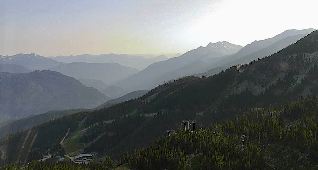
   Monday July 30, 2018. 06:45 Hrs.


VIDEOS:

Couple escape avalanche: Washington State

Why you should not be looking at your phone: While Driving


ARTICLES:

Several avalanches resulting in 2 deaths: Chamonix

French skier caught in an avalanche in 1954 recovered: Italy

Marker announces voluntary safety recall of 2017-2018 King Pin Bindings: July 26, 2018

ISSW 2018 in Austria: October 7-12

23 Jul 2018

July 23, 2018


   AVALANCHE ACTIVITY:

    No new avalanche activity to report.


    PAST WEEK:

    Tuesday morning July 17, 2018.  +17 Deg C at 06:30 Hrs.

    Wednesday morning July 18, 2018.

    Thursday morning July 19, 2018.

    Friday morning July 20, 2018.

    Saturday morning July 21, 2018.

    Sunday morning July 22, 2018. +9 Deg C at 06:00 hrs.


Weather Observations for July 23, 2018  taken at 06:00 Hours.

2240 meters        +9, Winds were 5-10 KPH NE  --Horstman Hut
1860 meters      +10, Winds were 5-10 KPH NNE--Rendevous
1650 meters      +11, 0.0 mm in 12 hours --Pig Alley
  660 meters      +10, Valley Temp, Max Temp Yesterday was +30.2, 0.0 mm of precip recorded yest


    As of 06:30 Hrs this am we have clear skies and unlimited visibility.


FORECAST:

High pressure will bring dry warm weather to the area today in a West-Southwest flow aloft. There is a chance of some cloud development and thunderstorms Northeast of our zone but we should see mostly sunny weather. The high builds for Tuesday and continues to dominate the pattern into next weekend. The freezing level will hover in the 3800 meter range, and rise during the week to 4500 meters by Saturday with above normal temperatures. The lakes will be busy!!!


    GOES IR image from this am.


      Omega block forming this week with warm dry weather.

    High pressure for today.


    Fronts along the coast.


    High for Tuesday.


    Warm temperatures moving in from the South.


    High builds through the week.

    High continues to dominate.


    Looking like nice weather into next weekend.


    INFORMATION & OBSERVATIONS:

    First Quarter, Monday evening. Full moon on July 27, 2018

   Tuesday morning. Features are being constructed. Crankworks August 10-19, 2018.

    Sunset in Ontario Wednesday.

    Wednesday on the West Coast.

    A few clouds around on Wednesday.

    Thursday morning.

    Busy Friday morning.

    Saturday sunset on Lake Simcoe.

    Sunday morning.

    Kees & Claire Hut in need of carpenters. Contact Liz Scremin 604-921-2651.

    Image from this am-- stratus cloud along the coast, cloudy to the North.


VIDEOS:

Above Antarctica: Drone Footage


ARTICLES:

Special weather statement in effect: Whistler

Scientist lack vital knowledge on rapid Arctic climate change: Science Daily

Jumbo is back in Court: Powder Canada