8 Feb 2023

February 8, 2023

     AVALANCHE ACTIVITY:

      An avalanche has killed a guided ski tourer on Col du Chardonnet, FR. Article below. Net Pic


      Large Na avalanche above popular ski touring route in Austria. Article below. Gerald Lehner Pic.

     Sz 1 Sa storm slab, 2023/02/07. Wendy Thompson Hut. MIN Report below.    Alessandrovlp Pic


      Avalanche mitigation on Whistler produced Sz 1-2 Xe Xl Xt Xc Sc Soft Storm slabs.

      Avalanche mitigation on Blackcomb: Sz 1-1.5 1-Sz 2 Xe Xc Xt Xl Sc. Sa Sz 1.5 Storm Slabs


     WEATHER YESTERDAY:

      Sunrise Tuesday was at 07:37 Hrs. -4 Deg C with a 25-35 KPH ESE wind at 1835 m.

      10:00 Hrs. -4 Deg C with a 20-35 KPH ESE wind at 1835 m. Snowing.


      Tuesday February 7, 2023. 12:00 Hrs. -3 Deg C with a 30-50 KPH South wind at 1835 m.


      14:00 Hrs. -3 Deg C with a 30-70 KPH SSW wind at 1860 m. 75-115 KPH  at 2280 m.

      16:08 Hrs. -4 deg C with a 20-55 KPH SSW wind. Flurries in the air at 1860 m.


Weather Observations for February 8, 2023 taken at 06:00 Hours.

2280 meters     -12, Winds were 20-25 KPH SSW--Horstman Hut
2180 meters     -10, Winds were 25-35 KPH SW--Whistler Peak
1860 meters     -10, Winds were 10-15 KPH SE --Rendezvous  
1835 meters       -9, Winds were 15-30 KPH SSW--Round House
1650 meters       -8, 5 cm in 12 Hrs, 10 cm in 24 Hrs. Base 206 cm--Pig Alley
1570 meters       -7, 2 cm in 12 Hrs,   7 cm in 24 Hrs. Base 136 cm--Catskinner
  660 meters       -2, Valley Temp, Max temp Yesterday was +3.0, 10 mm of precip yesterday.


      As of 06:00 Hrs this am, we have 5 cm of new snow. 3.0 mm in precip gauge. Base 206 cm.

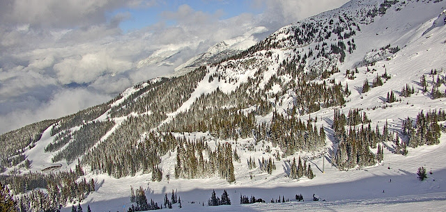
     As of 07:00 Hrs we have broken cloud and unlimited visibility.


FORECAST:

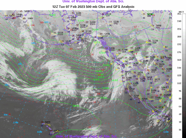
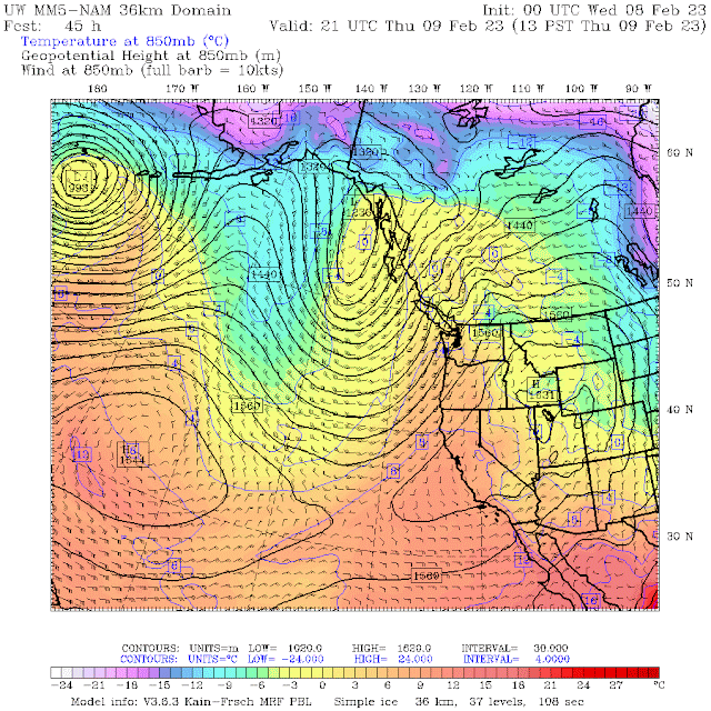
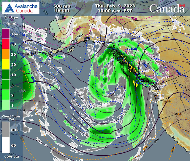
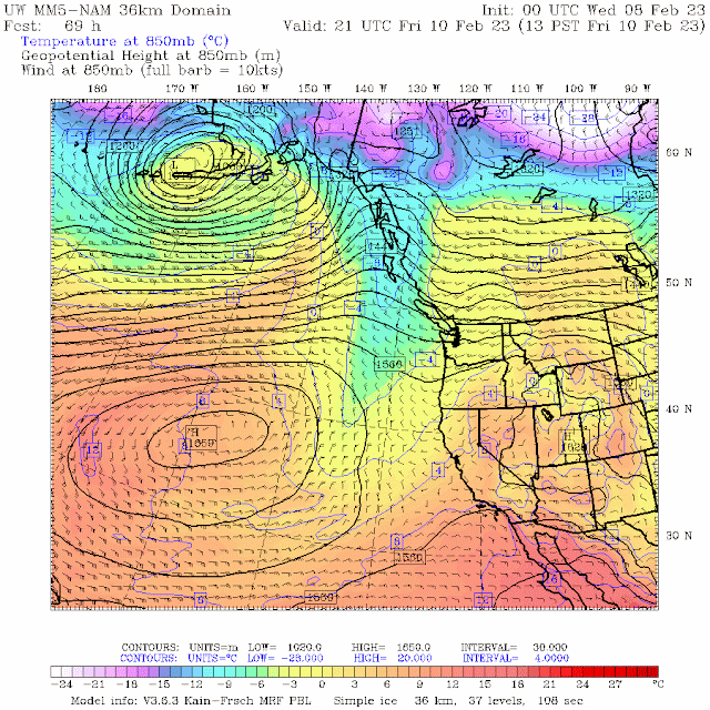
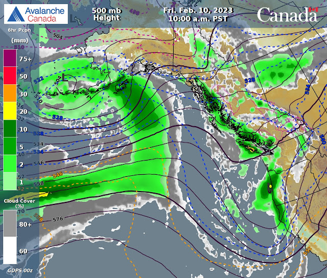
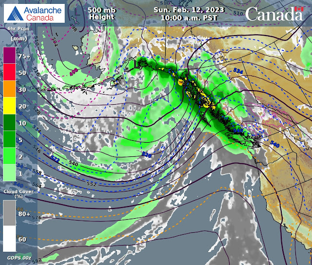
Dirty ridging for today with unsettled weather in a Westerly flow aloft. Relatively dry day with some flurries tonight. Might see some isolated convective flurries during the day??  The FL is below surface and may peak at 800 m. Frontal band arrives tonight with light snow down to the valley. Warm front eventually brings the Fl up to 1400 m by Thursday afternoon, second frontal band arrives later in the pm with light/moderate precipitation and strong winds. The front continues into early Friday am. Should see a break in the action by sunrise with a brief period of dry weather with some sunny breaks. Next frontal band arrives by Friday around noon with light snowfall into Saturday pm. Dries out late Saturday pm with overcast skies and some flurries. Dry early Sunday am with another frontal band arriving Sunday pm, intensifying Sunday night. Winter is back and the POW train continues into Monday. Dries out by Tuesday/Wednesday. Guesstimates: 1-4 cm by Thursday am, 18-22 cm by Friday am, 8-12 cm by Saturday am, 2-4 cm by Sunday am, 12-18 cm by Monday am, 8-12 cm by Tuesday am.


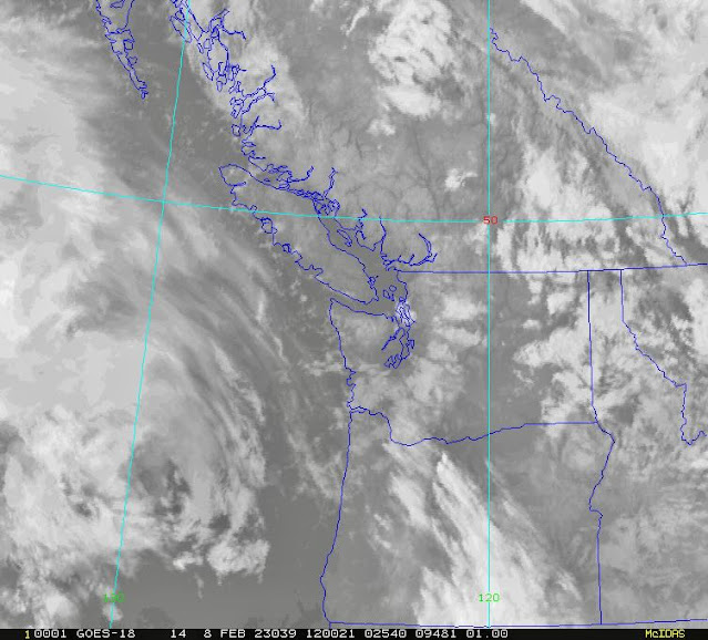
      GOES IR IMAGE FROM THIS AM.


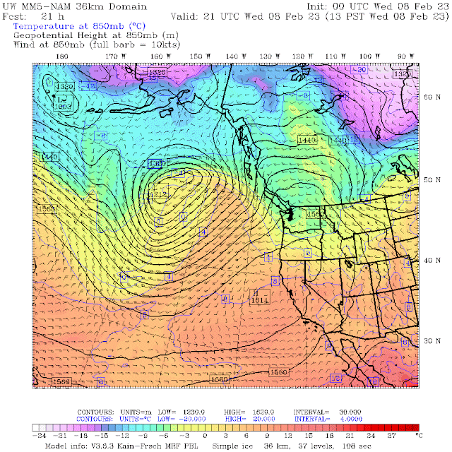
      WINDY IMAGE 2023/02/08. 05:00 Hrs.


        Cool dirty ridge for Wednesday. Mostly overcast with some breaks. Deep low to the North.


      Dries out Wednesday, clouds with some sunny breaks. 


     Westerly flow aloft.


        Low will usher in a warm front with a trailing cold front Thursday. Above average temps.


      Periods of light precipitation Thursday.


      Aleutian Low will bring more snow for Friday with cooler temperatures.


      Two frontal bands on Friday with light/moderate precipitation.

          High pushes back Saturday,  but low likely to win out with more precipitation. Cooler.


      Periods of light precipitation Saturday, dries out in the pm.


      Periods of light/moderate precipitation Sunday. Dry in the early am. 


      Light snowfall Monday with drier weather in the late pm.


      INFORMATION & OBSERVATIONS:

      Snow line was at 900 m at 09:00 Hrs. Snowing lightly.

      Avalanche Control Tuesday am.


     JC Chair was closed for a while, dud on Pakalolo tram. Have to wait 1 hour before eliminating the issue.


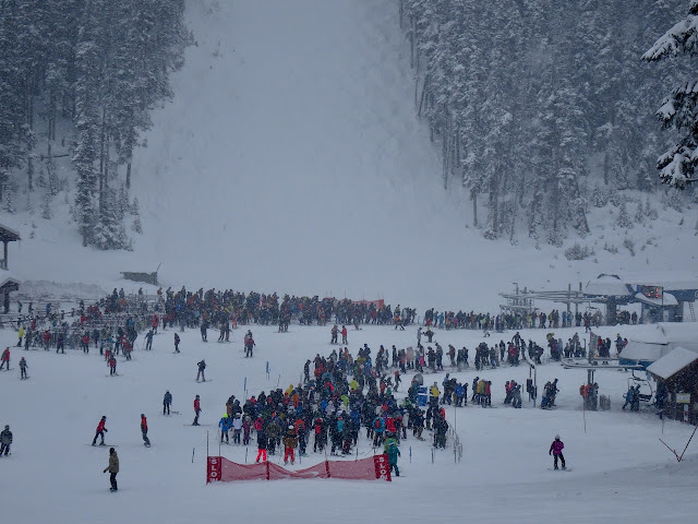
      Powder Pigs were out in force.

      Spanky's was a popular spot.


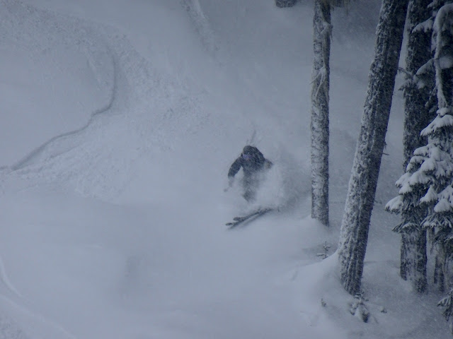
      Could have been a bit deeper but pretty nice snow.


      Heading up to Lower Disease Ridge.


      Nice snow in 7th Heaven once it opened.

      Convective Flurries at 13:15 Hrs.

      Too Much fun on a POW Day.


      A large sucker hole moved in around 14:00 Hrs.

      5 cm of new snow as of 14:30 Hrs. Base 138 cm at 1570 m.


     The Rooster!!


      Patches of Blue at 16:15 Hrs. With power flurries moving up the valley.


FROM AVALANCHE CANADA:


Travel and Terrain Advice

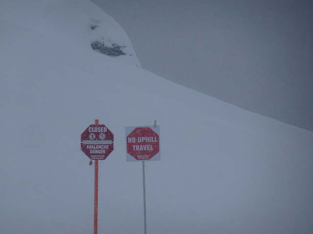
Watch for newly formed and reactive wind slabs as you transition into wind affected terrain.

As the storm slab problem gets trickier, the easy solution is to choose more conservative terrain.

Be especially cautious as you transition into wind affected terrain.


CONSIDERABLE--Sea to Sky Advisory available top right sidebar.


LOCAL MIN REPORTS:

Close call on Brohm Ridge: Feb 7, 2023

Storm Slab at Wendy Thompson Hut: Feb 7, 2023

Fresh Snow: Feb 7, 2023

Depencier Lake: Feb 7, 2023


SHORT CLIPS:

Skin Transition: Efficient Way 


Large Slab Avalanche: France

Another Day at the Office: Powder Patrol


ARTICLES:

Guided ski tourer killed, 1 seriously injured in Hautes-Alpes avalanche: France

 Large avalanche on popular ski touring route: Austria

10 of the most sustainable ski resorts in the world: CNN Travel

Powerful avalanches in the TOPR Lens: Tatras Mountains

Eleven Dead in avalanches in the Alps: PlanetSki


      If you enjoy the content and find it useful, please hit the donate button, top right on side bar.


Send me recent avalanche images. E-Mail top right of the side bar. Read Below:


Goggle contest returning again this year, win a pair of Marker goggles for the best avalanche image for the months of February-March, April-May.  Grand prize best image of the  season will be a Pair of Prior Skis or a Split Board awarded at the end of May. 

7 Feb 2023

February 7, 2023

      AVALANCHE ACTIVITY: 

      An avalanche has killed a hunter in the Osh Region, Krygastan. Article below.           Net Pic

      There have been numerous avalanches in Austria/Switzerland in the past 96 Hours.


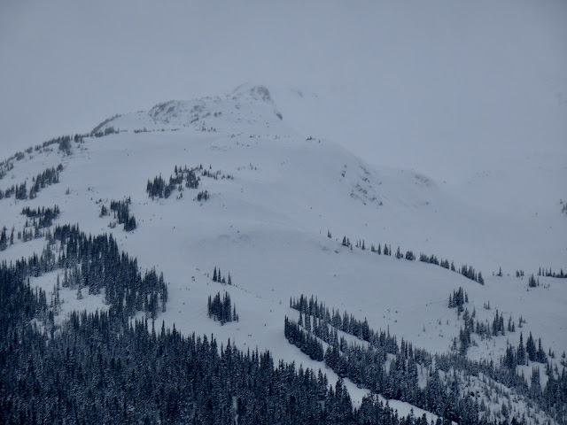
      No new avalanches observed on Whistler.


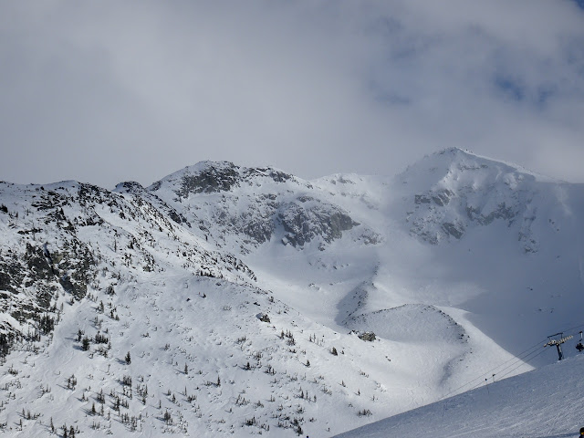
      No new avalanches observed on Blackcomb.


     WEATHER YESTERDAY:

      Sunrise Monday was at 07:39 Hrs. -3 Deg C with a 15-50 KPH South wind at 1835 m.


     10:00 Hrs. -3 Deg C with a 20-40 KPH South wind at 1860 m.


      Monday February 6, 2023. 12:00 Hrs. -3 Deg C with a 20-60 KPH SW Wind at 1835 m.

      14:00 Hrs. Some sunny breaks. -2 Deg C with a 25-75 KPH South wind at 1860 m.

      16:00 Hrs Light snow. -3 Deg C with a 35-55 KPH South wind at 1860 m.


Weather Observations for February 7, 2023 taken at 06:00 Hours.

2280 meters     -5, Winds were 65-85 KPH S--Horstman Hut
2180 meters     -4, Winds were 60-80 KPH E--Whistler Peak
1860 meters     -3, Winds were 30-50 KPH SE--Rendezvous  
1835 meters     -3, Winds were 15-40 KPH ESE--Round House
1650 meters     -1, 14 cm in 12 Hrs, 14 cm in 24 Hrs. Base 204 cm--Pig Alley
1570 meters     -2,   9 cm in 12 Hrs, 10 cm in 24 Hrs. Base 135 cm--Catskinner
  660 meters      0, Valley Temp, Max temp Yesterday was +3.5, 0.7 mm of precip yesterday.


     As of 06:00 Hrs this am we have 14 cm of new snow, 11.4 mm in the precip gauge. Base 204 cm.

      As of 07:00 Hrs this am we have obscured skies, limited visibility and snowing 1 cm per hr.


FORECAST:

A strong cold front will bring light/moderate precipitation with strong winds in a Westerly flow aloft. Front yesterday was very disappointing with lots of wind and no snow. Happens!! Nesters, yesterday recorded 0.7 mm of precipitation, Squamish recorded 22.6 mm. For today periods of light precipitation, dries out tonight with cooler temperatures. The FL is hovering around 1000 m and might rise to 1400 m before dropping to the valley tonight.  Dirty ridge for Wednesday with mostly overcast skies, a few breaks and some possible flurries. Another front for Thursday with periods of light precipitation during daylight hours, moderate precipitation Thursday night with a warm front. Lull in the precipitation Friday am with another weak front arriving later in the am. Periods of light precipitation Friday pm. Dries out Saturday with some flurries and overcast skies. Another frontal band Sunday. Guesstimates: 12-18 cm by Wednesday am, 1-3 cm by Thursday am, 18-22 cm by Friday am, 4-8 cm by Saturday am, 1-3 cm by Sunday am.


      GOES IR IMAGE from this am.


      WINDY IMAGE 2023/02/07. 05:00 Hrs.


       Cold front for Tuesday with cooler temperatures. 


      Periods of light precipitation for Tuesday. Some breaks this pm and a drying trend later pm.


      Westerly flow aloft.


       Dirty ridging for Wednesday with mostly overcast skies. Dry. Cooler.


      Weak dirty ridge for Wednesday.


       Low will send a frontal band on Thursday with periods of light/moderate precip. Warmer.


       Light am precipitation, turns moderate Thursday night.


       Weak front for Friday, light precipitation with slightly above average temperatures.


      Light precipitation for Friday.


       Dries out Saturday with overcast skies and flurries in the mix.


      Yet another front for Sunday with light precipitation. Just above average temps.


      INFORMATION & OBSERVATIONS:

      Snowing lightly at 09:30 Hrs. Felt like the front had arrived?!!


      Ridge Walking in moderate wind. Hearty.


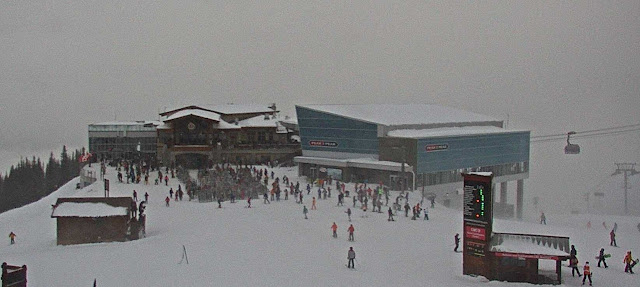
      On piste was more popular than off piste on Monday.


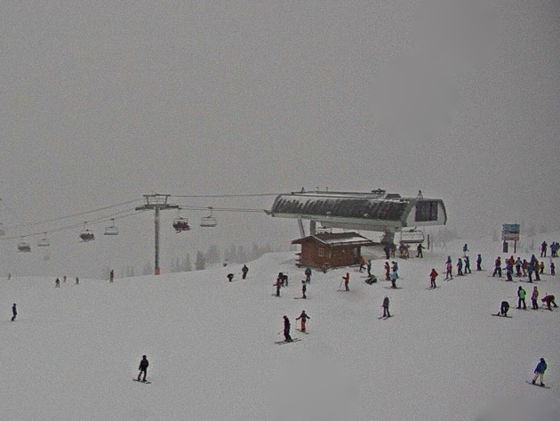
      Visibility was challenging at times mid mountain and in the alpine!.

      Some breaks during the am.


      Cornices are growing, soft noses.

     Ski Tourers on Lower Disease Ridge.


     There were  few breaks in the afternoon.


     Blowing hard on Chainsaw Ridge.


      Even with young eyes it is hard to commit when the visibility is compromised.


      Blowin but not snowin!! 


FROM AVALANCHE CANADA:


Travel and Terrain Advice

Storm slab size and sensitivity to triggering will likely increase through the day.

As the storm slab problem gets trickier, the easy solution is to choose more conservative terrain.

Be especially cautious as you transition into wind affected terrain.

Dial back your terrain choices if you are seeing more than 20 cm of new snow.


HIGH--Sea to Sky Advisory available top right sidebar.


Mountain Conditions Report: 


WB and Duffy lake Ski Conditions: Jan 6, 2023


LOCAL MIN REPORTS:

Honey Bronzed & Marriott Basin: Jan 6, 2023

Christmas Gully: Jan 6, 2023

S2S#2 and Spur: Feb 5, 2023

Van Horlick: Feb 5, 2023

Powder Mountain: Feb 5, 2023


SHORT CLIPS:

Tantalus Range: Spectacular

Spine Lines: Alaska

Big Effort: Never Give Up

World Record Ski Jump: 253.5 m


ARTICLES:

An avalanche has killed a hunter in the Osh Region: Kyrgyzstan

Two killed, one missing after road workers hit by avalanche in Himachel Pradesh: Kashmir

A man was injured in an avalanche near Castle Mountain resort: Alberta

Climate change causing snow avalanches in Kashmir: Northern India

Mountaineer survives being buried by avalanche for 20 Hrs in -15 Deg C: Italy

Avalanches in Austria--What you need to know to stay safe: Time.News

Allure of Japan's powder snow a growing danger as more tourists ski backcountry: Tokyo


      If you enjoy the content and find it useful, please hit the donate button, top right on side bar.


Send me recent avalanche images. E-Mail top right of the side bar. Read Below:


Goggle contest returning again this year, win a pair of Marker goggles for the best avalanche image for the months of February-March, April-May.  Grand prize best image of the  season will be a Pair of Prior Skis or a Split Board awarded at the end of May.