
AVALANCHE ACTIVITY:


YESTERDAY:


Weather Observations for January 20, 2017: taken at 06:00 Hours.
2240 meters -7, Winds were 30-50 KPH ESE--Horstman Hut
2180 meters -7, Winds were 30-45 KPH ESE--Whistler Peak
1860 meters -5, Winds were 5-10 KPH ESE--Rendevous
1835 meters -5, Winds were 15-25 KPH ESE--Roundhouse
1650 meters -4, 5 cm of new snow, 14 cm in 24 hrs, 243 cm Base, RH 98% --Pig Alley
1550 meters -4, 2 cm of new snow, 8 cm in 24 hrs, 164 cm Base, RH 97% --Catskinner
660 meters 0, Valley Temp, Max Temp Yesterday was +2.1, 12.3 mm of Precip recorded yest
 As of 07:00 Hrs this am we have scattered cloud and unlimited visibility.
FORECAST:
A weakening broad upper level trough will remain off the coast for the weekend. Today we will see unsettled conditions in a Southwesterly flow aloft. Patchy flurries are possible today in the alpine. Saturday will be overcast with some isolated flurries. Sunday is looking unsettled and drying out. A surface ridge will begin to influence the area by Monday with unsettled conditions. As of now Tuesday and Wednesday are looking sunny with seasonable temperatures. The freezing level will fluctuate from 1000 m to surface over the next few days. Guesstimates: Trace-1 cm for Saturday morning, 1-3 cm by Sunday morning.
 Unsettled weather for today, proceeding a drying trend.
 Flow for today.
 Low is weakening with showery and breezy weather for a few days.
 Sunny for Tuesday.
OBSERVATIONS:

VIDEO FRIDAY:
Old avalanche footage in Colorado: Ophir
Kirkwwod avalanche visits a living room: January 11, 2017
SAR Members story of ride in an avalanche: Colorado

FORECAST:
A weakening broad upper level trough will remain off the coast for the weekend. Today we will see unsettled conditions in a Southwesterly flow aloft. Patchy flurries are possible today in the alpine. Saturday will be overcast with some isolated flurries. Sunday is looking unsettled and drying out. A surface ridge will begin to influence the area by Monday with unsettled conditions. As of now Tuesday and Wednesday are looking sunny with seasonable temperatures. The freezing level will fluctuate from 1000 m to surface over the next few days. Guesstimates: Trace-1 cm for Saturday morning, 1-3 cm by Sunday morning.


OBSERVATIONS:
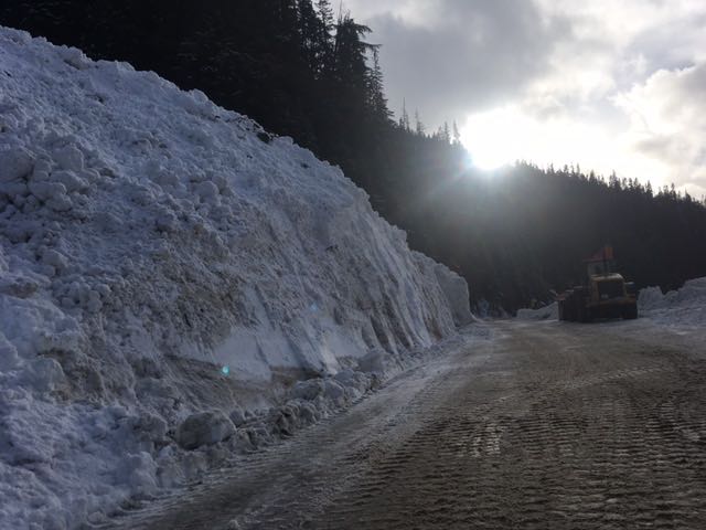
Hey Wayne,
Not the best photo as I snapped it as I drove by. This is the slide that came down naturally at 130am while the highway was open this morning after the MOT had previously done control. Jan 19, 2017 Jamie May
|
||||
|
||||


VIDEO FRIDAY:
Old avalanche footage in Colorado: Ophir
Kirkwwod avalanche visits a living room: January 11, 2017
SAR Members story of ride in an avalanche: Colorado
ARTICLES:
Snowboarders avalanche Survival sparks Social Media Discussion: Pique
Update on the Rigopiano Hotel Avalanche Disaster: Italy
Eight people found alive in hotel rubble: Italy
Avalanche awareness days on Blackcomb: January 21-22, 2017
No comments:
Post a Comment