
AVALANCHE ACTIVITY:


Wango, Coming down right side of Corona before the traverse right and looked over at Husume and saw this slide around 1:00pm Yesterday. #awilliephoto-- Natural Cornice release?


YESTERDAY:


Weather Observations for April 17, 2017 taken at 06:00 Hours.
2240 meters -3, Winds were 25-35 KPH S --Horstman Hut
2180 meters -3, Winds were 20-25 KPH S --Whistler Peak
1860 meters -1, Winds were 15-25 KPH SE--Rendevous
1835 meters -1, Winds were 10-15 KPH SE --Roundhouse
1650 meters -1, 3 cm of new snow, 3 cm in 24 hrs, 358 cm Base, RH 97% --Pig Alley
1550 meters -1, 3 cm of new snow, 3 cm in 24 hrs, 265 cm Base, RH 97% --Catskinner
660 meters +2, Valley Temp, Max Temp Yesterday was +13.0, 0.0 mm of Precip recorded yest
 As of 07:00 Hrs this am we have overcast skies, limited visibility and it is snowing.
FORECAST:
A weak trough pushed into the area early this morning in a Southwesterly flow aloft. We can expect an increase in precipitation as the day progresses with the FL rising to 1800 meters this afternoon. An impulse of precipitation tonight will bring moderate snowfall to the alpine. The front will continue into Tuesday with moderate snowfall in the alpine, easing as the day progresses, with the FL starting at 1700 meters and dropping to 1200 meters by Tuesday night. We may see a brief break Tuesday night before another front moves in for Wednesday. Yet another trough of low pressure is expected for Thursday. As of now we may see a weak ridge of high pressure build for Friday. More on that as we get closer.
Guesstimates: 14-18 cm by Tuesday morning, 8-12 cm by Wednesday morning, 15-20 cm by Thursday morning, 4-6 cm by Friday morning.
 GOES IR image from this am.
 Cloud and precipitation early Monday morning.
 Looking wet Tuesday.
 Another front for Wednesday.
 More weather for Thursday.
OBSERVATIONS & INFORMATION:
 Wind blown rimed snow.
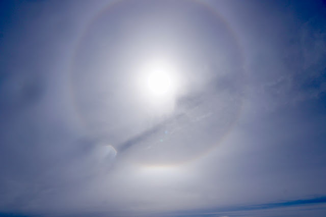 Sundog yesterday afternoon.
 Strong Easterly wind yesterday.
 Lakes should break up fairly soon.
ARTICLES:
Avalanche causes delays over Echo Summit: Lake Tahoe
This week's Backcountry news: April 10-16, 2017
For the best food in Whistler, you have to go to Pemberton: SnowBrains

FORECAST:
A weak trough pushed into the area early this morning in a Southwesterly flow aloft. We can expect an increase in precipitation as the day progresses with the FL rising to 1800 meters this afternoon. An impulse of precipitation tonight will bring moderate snowfall to the alpine. The front will continue into Tuesday with moderate snowfall in the alpine, easing as the day progresses, with the FL starting at 1700 meters and dropping to 1200 meters by Tuesday night. We may see a brief break Tuesday night before another front moves in for Wednesday. Yet another trough of low pressure is expected for Thursday. As of now we may see a weak ridge of high pressure build for Friday. More on that as we get closer.
Guesstimates: 14-18 cm by Tuesday morning, 8-12 cm by Wednesday morning, 15-20 cm by Thursday morning, 4-6 cm by Friday morning.


OBSERVATIONS & INFORMATION:


ARTICLES:
Avalanche causes delays over Echo Summit: Lake Tahoe
This week's Backcountry news: April 10-16, 2017
For the best food in Whistler, you have to go to Pemberton: SnowBrains
No comments:
Post a Comment