AVALANCHE ACTIVITY:
Some Sc wet loose Sz 1 on Blackcomb Sunday. Some Sz 1 Na wet loose observed.
Wet loose out of Sudan Couloir Saturday pm on sweep. Sc Sz1.
Moved slowly down the slope.
A different perspective of the Sz 1 wet loose. Debris ran down near the Moraine.
Looking up at Husume. Slide activity started at the End of April into Early May..
Moats appearing around the rocks with a very quick melt.
WEATHER YESTERDAY:
Sunrise Sunday was at 05:27 Hrs.
08:00 Hrs. +13 Deg C with a 5-20 KPH NNE wind at 1860 m.
10:00 Hrs. +13 Deg C with a 10-20 KPH NE wind at 1860 m.
Sunday May 14, 2023. 12:00 Hrs. +14 Deg C with a 10-20 KPH ESE wind at 1835 m.
14:00 Hrs. +13 Deg C with a 5-15 KPH ENE wind at 2280 m.
16:00 Hrs. +15 Deg C with a 10-25 KPH ESE wind at 2280 m.
Weather Observations for May 15, 2023 taken at 06:00 Hours.
2280 meters +11, Winds were 10-15 KPH NE--Horstman Hut
1860 meters +11, Winds were 8-12 KPH E--Rendezvous
1650 meters +9, 0 mm in 12 Hrs, 0 mm in 24 Hrs. Base 175 cm--Pig Alley
1570 meters +11, 0 mm in 12 Hrs, 0 mm in 24 Hrs. Base 84 cm--Catskinner
660 meters +8, Valley Temp, Max temp Yesterday was +31.1, 0.0 mm of precip yesterday.
High Sunday at 2280 m was + 15.3 Deg C at 19:00 Hrs.
High in the valley Sunday was 31.1 Deg C. Squamish High was +35.8 Deg C.(Records broken)
Should be a 09:15 upload today.
No precipitation recorded at 1650 m. Base 175 cm. Last Monday the Base was 204 cm.
As of 07:00 Hrs we have clear skies and unlimited visibility. +11 Deg C.
FORECAST:
Strong upper level ridge will bring mostly sunny skies for today in an Easterly flow aloft. Will see some convective cloud development from the low to our South later in the afternoon. The FL is hovering well above the local peaks, and should rise to around 4000+ m today. Ridging continues into Tuesday with mostly sunny skies and some clouds later in the pm. Mix of sun and cloud for Wednesday. Mostly sunny on Thursday with some pm clouds. Mix of sun and cloud on Friday with some convective activity that may bring some isolated showers. Time will tell. More on that as we get closer. Mix of sun and cloud Saturday. Ditto for Sunday. Cooler and wetter by early next week according to some long range models. Guesstimates: No precipitation until possibly Friday.
GOES IR IMAGE from this am.
.jpeg)
WINDY IMAGE 2023/05/15. 05:00 Hrs.
Large High with a North moving, upper level low to the South.
High pressure will bring sunny skies this am, some convective cloud development in the pm.
No precipitation for Monday. Low slowly moving North.

Easterly flow aloft.
.jpeg)
Low has the potential for convective cloud development with lightning to SouthEast B.C.

Low will bring some cloud into the area in the pm, sunny in the am. Above average temps.

Some cloud but dry on Tuesday.

Mix of sun and cloud on Wednesday. Above average temperatures.

Dry with some pm clouds on Wednesday.
High pressure still in control. Some pm cloud. Above average temperatures.
High still keeping the low at bay. Another dry day.
Mix of sun and cloud for Friday, possibility of some showers.
Mix of sun and cloud on Saturday. Cooler but still above average temps.
INFORMATION AND OBSERVATIONS:
Awesome Sunday morning, Happy Mothers Day hope you all had an awesome day!
First light on Whistler Peak.
Rumbling Glacier.
Gliding Avalanches
Smoke from the Squamish Valley Fire, Saturday afternoon. Click>
Squamish Valley Fire Update
Haze from the Fire in the Squamish Valley Sunday am.
7th Heaven closed just after 11:00 Hrs due to Avalanche Risk. GE closed early but later in the pm.
Black Tusk
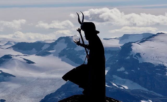
Your Captain Here, "Below you can see the once World Class Ski Resort of Whistler."
Switch on a skim!
Loosing your ski in the slush sucks!!!
Kudos to the groomers for keeping the egress ribbon going.
FROM AVALANCHE CANADA:
Backcountry Avalanche Advisory – Sea to Sky
Avalanche Canada advisories are done for the season. Advisories are typically available in fall, winter and spring (October – April). Please check back in Fall 2023 for Whistler and the Sea to Sky region advisories. If you're heading into the mountains this spring, learn more about assessing spring conditions.
LOCAL MIN REPORTS:
No new MIN Reports as of 07:00 Hrs.
SHORT CLIPS:
T-Bar: Gap Jump
Smooth Fresh Cord: Turns
Sand Boarding: Peru
Crazy Crash: Dominoes
ARTICLES:
All melt, No freeze scenario: Avalanche Canada
Spring Considerations for avalanche forecasting: WildSnow
The Mysteries of glide avalanches: ScienceNorway
Tourists flee as an avalanche comes down on road in Tibet: YahooNews
Connecticut women sues Keystone Ski Patrollers for accident while being rescued: Colorado
If you enjoy the content and find it useful, please hit the donate button, top right on side bar.
Send me recent avalanche images. E-Mail top right of the side bar. Read Below:
Goggle contest returning again this year, win a pair of Marker goggles for the best avalanche image for the months of April-May. Grand prize best image of the season will be a Pair of Prior Skis or a Split Board awarded at the end of May.

.jpeg)
.jpeg)
.jpeg)
.jpeg)
.jpeg)
.jpeg)
.jpeg)
.jpeg)
.jpeg)
.jpeg)
.jpeg)
.jpeg)
.jpeg)
.jpeg)

.jpeg)
.jpeg)


.jpeg)


.jpeg)
.jpeg)
.jpeg)
.jpeg)
.jpeg)
.jpeg)
.jpeg)
.jpeg)
.jpeg)
.jpeg)
.jpeg)
.jpeg)

.jpeg)
No comments:
Post a Comment