22 Aug 2022

August 22, 2022

     PAST WEEK:

      Monday August 15, 2022. 12:00 Hrs. +14 Deg C with a 5-10 KPH NW breeze.


     Tuesday August 16, 2022. 12:00 Hrs. +14 Deg C with a 5-15 KPH NW wind.

      Wednesday August 17, 2022. 12:00 Hrs. High in the valley was +34.6 Deg C.

      Thursday August 18, 2022. 12:00 Hrs. +22 Deg C with a 5-15 KPH ENE wind.

      Friday August 19, 2022. 12:00 Hrs. +16 Deg C with a 20-35 KPH SW wind.


      Saturday August 20, 2022. 12:00 Hrs. +16 Deg C with a 5-10 KPH WNW breeze.

      Sunday August 21, 2022. 12:00 Hrs. +13 Deg C with a 5-10 KPH WNW breeze.

   
Weather Observations for August 22, 2022 taken at 06:00 Hours.

2180 meters    +11, Winds were 10-15 KPH SSW--Whistler Peak 
1835 meters    +12, Winds were     0-5 KPH ESE--Round House
1650 meters    +10, 0.0 mm in 12 Hrs, 0.0 mm in 24 Hrs --Pig Alley
  660 meters    +12, Valley Temp, Max temp Yesterday was +26.4, 0.0 mm of precip yesterday.

 
      As of 07:15 Hrs this am we have some scattered cloud and unlimited visibility.


FORECAST:

High pressure still giving mostly clear skies this am to our zone in a Southerly flow aloft. Weak short wave trough to the South will send some cloud our way as the day progresses. Mix of sun and cloud by this afternoon. Low developing from the trough will bring mostly cloudy skies for Tuesday. Dirty ridging for Wednesday with a chance of some isolated convective showers. Ridge rebuilds Thursday but will likely see some cloud in the mix as well. Mix of sun and cloud for Friday into the weekend. There is some uncertainty in the forecast as model runs are different as the week progresses. May see some precipitation Friday into the weekend. Depends on which model will be right.  Overall, still looking like nice summer weather for the West Coast. Guesstimates: 0 mm by Tuesday am, 0 mm by Wednesday am, 0-1 mm by Thursday am, 0 mm by Friday am, 0 mm by Saturday am, 0 mm by Sunday am. 


      GOES IR Image from this am.


      GOES 17 ABI Image 2022/08/22. 05:00 Hrs.


      High still in our zone, but lots going on around the South Coast. 


      Dry but should see some convective cloud development by Monday afternoon.


      Southerly flow aloft today.


            High receding Tuesday, could see mostly cloudy skies from the low to the SE. 


       Dry but clouds likely on Tuesday.


      Low from the South may bring some convective showers Wednesday.


     On the edge of the low, likely see some showers Wednesday.


      Looks dry for Thursday, mix of sun and cloud.


      Looking dry in this model, mix of sun and cloud Friday.


      Dry, mix of sun and cloud Saturday.


      High pressure more than likely for Sunday. 6 days away? 


      AVALANCHE ACTIVITY:

      Sz 1 cornice collapse, snowboarder hiking ridge near Queenstown, NZ. Aug 20, 2022. Bart Pic


      INFORMATION & OBSERVATIONS: 

      Monday 21:00 Hrs. Sunrise was at 20:31 Hrs. Loosing 3 minutes of daylight per day. 

      Tuesday was an awesome day. High in the valley was 28.9 Deg C.

      Wednesday evening. Still melting.

      Great colours at sunset Wednesday. 


      Overlord Glacier.


     Receding Glaciers, Tantalus Range Friday.

      Isolated showers in the Sea to Sky Corridor Friday. Whistler recorded 0.3 mm of rain.

      21:00 Hrs Saturday. 


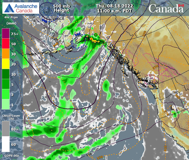
      Weak upper level trough developing offshore Sunday morning. Ridging over lower SW B.C.


      Sunday morning.


VIDEOS:

Some European Alpine Huts closing due to: Rockfall

Powder Skiing: Chile


ARTICLES:

Keeping an eye on the Seasons Snowpack: Australia

Avalanche Incidents in New Zealand: Past 20 years

MSU's Sub Zero Lab progresses water runoff and avalanche prediction: Montana

Arctic warming 4X faster than the rest of the planet: Life in Norway

15 Aug 2022

August 15, 2022

      PAST WEEK:

      Monday August 8, 2022. 12:00 Hrs. +18 Deg C with a 10-15 KPH West wind.

      Tuesday August 9, 2022. 12:00 Hrs. +19 Deg C with a 5-10 KPH NW breeze.

      Wednesday August 10, 2022. 12:00 Hrs. +20 Deg C with a 10-15 KPH N wind.


      Thursday August 11, 2022. 13:00 Hrs. +20 Deg C with a 10-15 KPH N wind.


      Friday August 12, 2022. 12:00 Hrs. +16 Deg C with a 5-15 KPH WNW wind.


      Saturday August 13, 2022. 12:00 Hrs. +8 Deg C with a 5-15 KPH SSW wind.


     Sunday August 14, 2022. 12:00 Hrs. +12 Deg C with a 5-10 KPH West breeze.


Weather Observations for August 15, 2022 taken at 07:00 Hours.

2180 meters    +10, Winds were 5-10 KPH SSW--Whistler Peak 
1835 meters    +12, Winds were   0-5 KPH ESE--Round House
1650 meters      +9, 0.0 mm in 12 Hrs, 0.0 mm in 24 Hrs --Pig Alley
  660 meters    +11, Valley Temp, Max temp Yesterday was +26.2, 0.0 mm of precip yesterday. 


   As of 07:00 Hrs this am we have clear skies above, some broken cloud to the N, and unlimited visibility.


FORECAST:

Ridge of high pressure will bring seasonable temperatures for today in a South West flow aloft. The trough in the Gulf of Alaska will send some cloud our way today but certainly a nice summer day. Ridge strengthens Tuesday into Wednesday with warming temperatures. Trough will likely send some cloud our way Thursday with more cloud arriving Friday. Models are trending towards a mix of sun and cloud Friday with some showers. The weekend will see a mix of sun and cloud with cooler temperatures. Guesstimates: 0 mm until Friday. trace-2 mm by Saturday am, 0 mm by Sunday am.


      GOES IR Image from this am.

      GOES 17 ABI Image 2022/08/15. 06:00 Hrs.

      Upper ridge over Southern BC, large low North. Warm air moving in from the South.


     Low will send some cloud our way. Looking dry with warming temperatures for today..


      South Westerly flow aloft. Click for some extra reading-Walker Circulation

      High strengthens Tuesday with mostly sunny skies.


      Some lingering cloud off the coast, looking sunny Tuesday.


      High still dominating Wednesday, warmer with sunny weather.

      Dry on Wednesday with some cloud off the coast. Looking sunny.


      Low eventually sends some cloud our way, mix of sun and cloud Thursday.


      Some moisture arrives on Friday, may see some showers, sunny breaks and cloud.


      Low off the coast will bring a mix of sun and cloud for Saturday.


      Mix of sun and cloud for Sunday as well, but time will tell.


      AVALANCHE ACTIVITY:

  
      Na Sz 3 windslab near Two Thumbs, NZ. August 15, 2022.                               David Ayre Image


     Sz 1.5 Sa wind slab 2022/08/14. Near Mt Olliver, NZ.                                          Nick Pascoe Image


      Storm Slab near Mt Cook, NZ. Aug 9, 2022. Sz 2 Na (naturally occurring).                   Will image


      INFORMATION & OBSERVATIONS: 

      Armchair Glacier Monday August 8, 2022. Max temp at 2280 m was +17 Deg C, 660 m was 31.9.


      Smoke may drift in from the South as the low moves up the coast!! Monday evening.


      Tuesday around noon, clouds were pushing in from the South. High 0f 33.8 Deg C in the valley.


      Nice light Tuesday evening.


      Hazy on Wednesday. Inflow in the valley.


      Hazy on Thursday as well!!


      Friday afternoon. Lots of melt in the past week.

      Saturday am, clouds moved in as a broad upper trough pushes in with a SW flow aloft.

      Red Bull Joy Ride Saturday Evening. High in the valley on Saturday was +20.9 Deg C.

      Big Air on Saturday, tough course!!!


      Sunday just before midnight.


VIDEOS:

Flying into Portillo, Chile: Looking like a good winter

Kapuche Lake Avalanche: Nepal

Top 3 Slopestyle Runs: Crankworks Whistler


ARTICLES:

ENSO Report August 11, 2022: NOAA

Avalanche Transceiver Interference and Search Suggestions: Powder Canada

From May 22, 2022. Video and description of what not to do in avalanche terrain!: Unofficial Networks

Beyond the Boundary: Australia

Farmers' Almanac predicts brisk BC winter starting in November: Pique

1000 year rain event causes destructive flooding in Death Valley: California

Heatwaves close off classic Swiss and Italian hiking Routes: Alps

Soldiers remains discovered after avalanche burial 38 years ago: Kashmir