
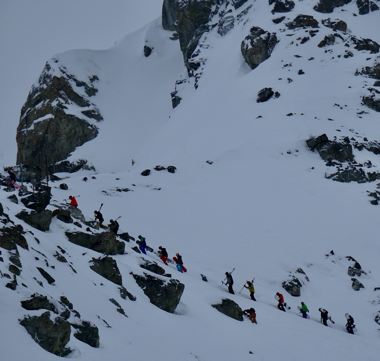
AVALANCHE ACTIVITY:
.jpeg)
.jpeg)
.jpeg)
.jpeg)


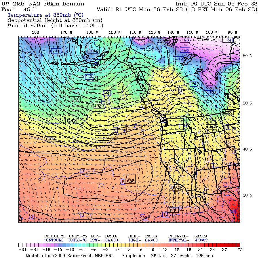
WEATHER YESTERDAY:
.jpeg)
.jpeg)


.jpeg)
Weather Observations for February 6, 2023 taken at 06:00 Hours.
2280 meters -6, Winds were 65-85 KPH S--Horstman Hut
2180 meters -6, Winds were 50-70 KPH SSW--Whistler Peak
1860 meters -3, Winds were 20-40 KPH S--Rendezvous
1835 meters -3, Winds were 15-40 KPH SSW--Round House
1650 meters -2, trace in 12 Hrs, trace in 24 Hrs. Base 195 cm--Pig Alley
1570 meters -3, trace in 12 Hrs, trace in 24 Hrs. Base 127 cm--Catskinner
660 meters +2, Valley Temp, Max temp Yesterday was +4.6, 0.0 mm of precip yesterday.
.jpeg)
.jpeg)
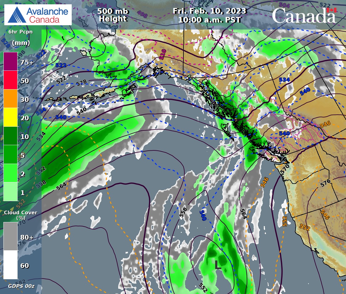
FORECAST:
A pineapple express is heading our way Monday am in a Northwesterly flow aloft. The FL is at around 1200 m and hopefully tops out at 1400 m, might go a bit higher. Cools down Tuesday with it hovering in the 1000 m range slowly dropping to surface by Tuesday night. For today we can expect strong winds and light/moderate precipitation. More of the same for Tuesday. Dries out Wednesday with a dirty ridge bringing unsettled weather. The models are not in agreement for Thursday into the weekend. Siding with the ECMWF and hope to see more snow Thursday and Friday. Dries our Saturday. More on later in the week in tomorrows post. Guesstimates: 20-25 cm by Tuesday am, 12-18 cm by Wednesday am, trace-1 cm by Thursday am, 10-15 cm by Friday am, 8-14 cm by Saturday am.

.jpeg)


.jpeg)
.jpeg)
INFORMATION & OBSERVATIONS:
.jpeg)

.jpeg)
.jpeg)


.jpeg)
.jpeg)
.jpeg)
FROM AVALANCHE CANADA:
Travel and Terrain Advice
Storm slab size and sensitivity to triggering will likely increase through the day.
As the storm slab problem gets trickier, the easy solution is to choose more conservative terrain.
Be especially cautious as you transition into wind affected terrain.
Dial back your terrain choices if you are seeing more than 20 cm of new snow.
CONSIDERABLE--SEA TO SKY ADVISORY TOP RIGHT SIDEBAR.
LOCAL MIN REPORTS:
Russet Ridge: Jan 5, 2023
Musical Bumps: Jan 5, 2023
Rainbow Conditions: Jan 5, 2023
Mount Sproatt: Jan 5, 2023
Wet Snow to the top of snow-(North Shore): Jan 5, 2023
Heavy Pow + Wind Slab-(Squamish): Jan 5, 2023
Tetrahedron: Feb 5, 2023
Stadium Glacier: Jan 5, 2023
Pump Peak Laps: Feb 5, 2023
SHORT CLIPS:
Yard sale: Ouch
Steep Narrow Turns: X3
Cheap Powder Skis: OSB
So Fast: Left the sluff in the dust
ARTICLES:
Weekend Avalanches kill 11 in Austria, Switzerland and Italy: SwissInfo
Snowplough driver dies in an avalanche in Austria. Stubenweg
Avalanches kill two in Switzerland: TheLocal
Avalanche kills two highway workers in Lahaul: Kashmir
Numerous avalanches involving people: Austria
Acting at One's own risk puts other lives in danger: Japan
Two ski patrollers spend the night with avalanche survivor in Alberta: Castle Mountain

If you enjoy the content and find it useful, please hit the donate button, top right on side bar.
Send me recent avalanche images. E-Mail top right of the side bar. Read Below:
Goggle contest returning again this year, win a pair of Marker goggles for the best avalanche image for the months of February-March, April-May. Grand prize best image of the season will be a Pair of Prior Skis or a Split Board awarded at the end of May.
.jpeg)

.jpeg)


.jpeg)

.jpeg)


.jpeg)


.jpeg)
.jpeg)

.jpeg)


.jpeg)
.jpeg)
.jpeg)
.jpeg)