10 Jul 2015

July 10, 2015

    July 9, 2015 Smoke from local fires chocking the valley.

    Looks thick up towards Pemberton.

    Yesterday's satellite image, very clear except for the stratus cloud layer along the coast.

    Big picture from July 9, 2015.


Weather Observations for July 10, 2015: taken at 03:00 Hours.

2180 meters      +14, Winds were 20-25 KPH from the SSW
1835 meters      +16, Winds were 15-20 KPH from the SSW
1650 meters      +15, Relative Humidity 70%
  660 meters      +17, Valley Temp, Max Temp Yesterday was +33.0.


For the forecast, upper level ridge is weakening today and will start moving East. An offshore upper trough will move into the area later today with cooler and cloudy conditions in a Southwest flow aloft. Showers are forecasted over the weekend into Monday or Tuesday. The air mass may dry quickly by Wednesday for a return to warm dry conditions, but more on that in Monday's post.


    Upper level ridge will shift East, Upper level trough to the North will move down the coast.

    Smoky but warm today.

    Trough comes down the coast for cooler temperatures and hopefully some rain.

    Cooler and cloudy by Sunday.

    Cloudy and cooler with some precipitation for Monday.

    Drier weather by mid week.


VIDEO FRIDAY'S:

Threading the needle: Wingsuit

Crazy Cliff Jumper: Lynn Canyon

New Avalanche Safety Device: Alexey Zhukov


ARTICLES:

Avalanche triggered in Mt. Cook National Park: New Zealand

One dead , four injured in ice cave collapse: Washington State

BC Fires have a cooling effect on Seattle Area: Cliff Mass


    One of the many fishing camps along the Restigouche River.


    Great camping spots along the Restigouche.

    East Coast sunset.

    Motor canoeing down the river.

6 Jul 2015

July 6, 2015

    July 4, 2015-A few clouds but warm and sunny.

    July 5, 2015--Smoke in the air.

    Big picture July 5, 2015.


Weather Observations for July 6, 2015: taken at 03:00 Hours.

2180 meters      +14, Winds were 10-20 KPH from the S
1835 meters      +16, Winds were 5-10 KPH from the SSE
1650 meters      +11, Relative Humidity 37%
  660 meters      +14, Valley Temp, Max Temp Yesterday was +32.9.


For the forecast, upper level ridge continues to dominate the weather pattern. To add to the mix a thermally induced surface low assists in the high temperatures. Good chance of some clouds Tuesday but the airmass looks dry, so unlikely of any rain.  Sunny weather for the week with a change possibly by the weekend as a weak upper level trough pushes onshore. Would be nice for a few days of rain to quell the fires.


ARTICLES:

Polar Blast intensifies Winter: New Zealand

Smoke and air quality a concern: Fires in Pemberton

Not much happening in the avalanche world!!


    Estuary at Carleton on the Bay of Chaleur.

    Looking up the Bay Chaleur.

    Fishing Camp on the Restigouche River.

    Canoeing down the Restigouche.

    Fishing for the elusive Atlantic Salmon.

    East Coast sunset.

3 Jul 2015

July 3, 2015

    June 30, 2015. A few clouds but amazing conditions.

   Lots of stratus cloud along the coast on the 30Th.

    Early Tuesday morning looking up Howe Sound.

    July 1, 2015--Could not be better for Canada day!!

    Portillo, Chile is not having an ideal winter season!!!

    July 2, 2015--Groundhog Day over and over again.


Weather Observations for July 3, 2015: taken at 06:00 Hours.

2180 meters      +16, Winds were 0-5 KPH from the SSE
1835 meters      +18, Winds were 0-5 KPH from the S
1650 meters      +14, Relative Humidity 72%
  660 meters      +14, Valley Temp, Max Temp Yesterday was +34.5.

In June 2015 we received 12.9 mm of rain at the Nester's weather station, the least amount of precipitation for June in the past 10 years and likely a record.  June 2014 we received 20.4 mm of rain which is still extremely dry. In the past 10 years June 2006 was the wettest with 76.4 mm recorded at the Whistler weather station.

    As of 07:00 Hours this am we have clear skies and unlimited visibility.


For the forecast, persistent ridge of high pressure will remain over the South coast of B.C. into at least next week with continued sunny and unseasonably warm temperatures. Looks like slightly cooler temperatures by next Tuesday.


VIDEO FRIDAY'S:

King of the Alps: Extreme Kayaking

Through the Bull's Eye: Wingsuit Precision

Windsurfing in Hurricane conditions: Red Bull Storm Chase 2014


ARTICLES:

Three terrain stages for Safely Riding in Avalanche Areas: John Buffery

Sand Avalanche buries Loader operator: Plymouth, PA


    One of the many churches along the St Lawrence River.

    Everyone needs a claim to Fame.

    Pickers missed some.

    Fishing on the Restigouche River.

    Early morning light looking at Sugarloaf Mountain near Campbellton, N.B.

    East Coast Gold Finch.

29 Jun 2015

June 29, 2015


    Awesome day June 26, 2015.

    Stratus cloud along the coast on Friday.

    A few clouds around June 27 Th but very warm temperatures and mostly sunny.

   Satellite image from Saturday, low to the South is forming.

    Sunday June 28, 2015--Started off as a nice day. + 27 recorded at 2180 meters at 08:00 hrs.

    Image from Sunday morning.

    High cirrus cloud Sunday morning.

    Looking North.

    Cloudy but warm by mid day.

    Corresponding image to above time frame.

    Light rain in the mountains by early Sunday evening.

    Low moved in by Sunday evening, we received 1.7 mm of precipitation by midnight.


Weather Observations for June 29, 2015: taken at 06:00 Hours.

2180 meters      +10, Winds were 10-15 KPH from the NNE
1835 meters      +15, Winds were 5-10 KPH from the SSE
1650 meters       No data available
  660 meters      +15, Valley Temp, Max Temp Yesterday was +35.6, it rained 1.7 mm up to midnight.
Record high temperature for Whistler Yesterday.

    As of 07:00 Hrs this am we have mostly overcast skies with unlimited visibility.


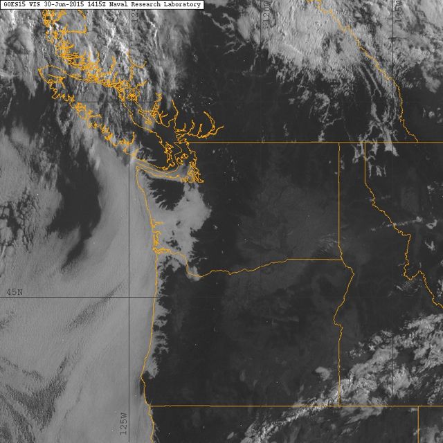
    Satellite image from this morning.


For the forecast, a weak low pressure system in a Westerly flow will move through the area today with a few breaks in the clouds. The air mass is slightly unstable and appears to be relatively dry. Slight chance of some dry lightning later this afternoon. There is still a chance of some isolated showers expected for today but it looks like a short lived high is developing.  A weakening trough will pass through Tuesday with unsettled conditions, mostly sunny Tuesday morning with some cloud development in the afternoon. We can expect slightly cooler temperatures for today into Tuesday but they will go back to the low 30's as the ridge rebuilds for Wednesday into the weekend with warm sunny conditions.


    Southerly flow last night will shift to Westerly this morning.

    Chance of some isolated showers today.

    Dry Tuesday as the trough moves East.

    Ridge begins to build Tuesday, strengthening Wednesday.

    Hot by Thursday.


ARTICLES:

More than 100 riders died in the Alps this past winter--Why?: Vice Sports

How North America Skiers can help Skiers in South America's backcountry: Calgary Hearld

Other parts of the world are also experiencing extreme heat: Pakistan and India

Alta defends right to keep snowboarders out: SnowBrains

Analysis shows increased carbon intensity from Canadian Oil Sands: Science Daily


    Even the spit was busy on Saturday.

    Moon Saturday evening June 27, 2015. Full moon is July 1 St, known as the Buck Moon.

    Snow on the glacier is melting quickly with 20 + degree temps at 2240 meters over the weekend.

    Horstman Glacier Sunday morning.

    Nita Lake early Sunday morning.

    Docks on Nita Lake.

    Looking towards Alpha Lake.

    Nita lake Lodge.