27 Nov 2016

November 27, 2016

Avalanche Activity:

    An avalanche in the Obergurgl area of Austria has claimed a skier: article below--Net Pic

Limited observations on W/B yesterday, Na, Sc issol ssl Sz 1-2 on steep terrain.

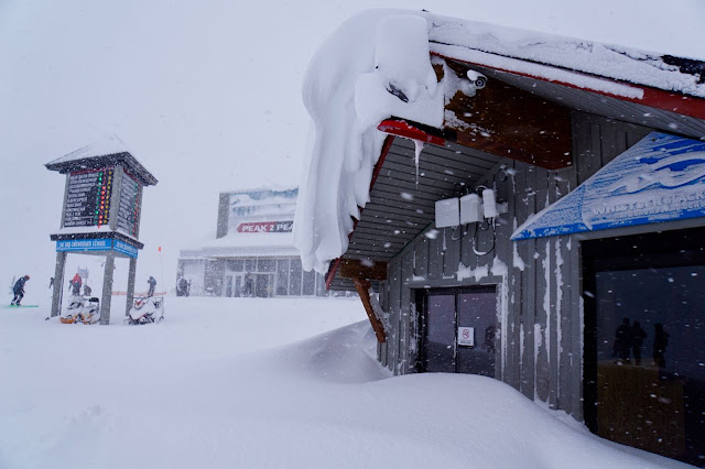
    Saturday morning, November 26, 2016-snowing to the valley.

    Snowing with awesome conditions Saturday morning.

    Powder to the valley in the am, moist but certainly a good base.

    A White, River of Golden Dreams.


    Saturday Morning

    Saturday afternoon.


Weather Observations for November 27, 2016: taken at 06:00 Hours.

2240 meters    -7, Winds were 20-30 KPH S    --Horstman Hut Station
2180 meters    -6, Winds were 20-30 KPH S    --Whistler Peak
1860 meters    -6, Winds were 10-20 KPH SE  --Rendevous
1835 meters    -5, Winds were 10-15 KPH SW --Roundhouse
1650 meters    -4, 5 cm of new snow, 31 cm in 24 hrs, 200 cm Base, RH 99%  --Pig Alley
1550 meters    -4, 5 cm of new snow, 44 cm in 24 hrs, 142 cm Base        --Catskinner 
  660 meters     0, Valley Temp, Max Temp Yesterday was +0.7. 14.3mm of Precip recorded yest


    As of 07:00 Hrs this am we have broken cloud and variable visibility.

For the forecast:

Unsettled conditions this morning in a Northwesterly flow aloft. A weak upper level trough pushes through later in the day with some light precipitation and Fl dropping to the valley. Monday is looking unsettled with a weak ridge building into Tuesday. Guesstimates 4-8 cm by Tuesday morning. A well deserved break in the action!!

    Looking fairly benign today.


    Unsettled with the chance of some light snow later in the day.


ARTICLES:

Snowboarder dies of snow immersion on Blackcomb on Saturday: Pique

Snow Immersion and Tree Well Suffocation: Be careful with this much snow

One skier dies another seriously injured in an avalanche: Austria

Fresh snow on local Mountains prompts Avalanche Warning: News 1130

ABS unveils Partner Activation Air Bag: ABS

Observations:


November 26 at 7:40pm

We went for a swim at Red Heather. We arrived Friday night and left Saturday afternoon and the snow was heavy and continuous for that time. I'd guess 30+ cm overnight with winds calm to light. Depth is about 200 cm at 1600m. The storm snow should be treated carefully for avalanche danger. Boot pen is practically unlimited. While digging a pit, I sunk to my mid-chest. A few small trees came across the trail overnight and it would be awesome if they were removed before they get too covered in snow. I did not have a handsaw on me. The road was a circus and uphill travel had been closed at the time that we went down due to a car partially obstructing the road which also meant that it had not been plowed.


November 26 at 5:45pm

Some friends and I had to dig out a guy from a tree well today. He was last in a group and his mates had zipped off ahead of him. Could have been pretty bad. 

It might be deep put play safe people.


    Its winter in the valley.

    We have alot of snow, 208 cm recoded at 1650 meters in the past week.

    Good skiing right to the valley.

    Awesome conditions on Saturday.


    Skinning down the road!!

26 Nov 2016

November 26, 2016

Avalanche Activity:

    Xh hanging roll on Whistler Mountain Friday afternoon.


    Xh 161125 Hanging Roll sz 3.5 with 1kg + 2kg.                                              Hiro Okazaki Image

Yesterday avalanche control produced mostly Sz 1-2 ssl with one Sz 3.5-Xh, Xe, Sc.
Natural activity observed on Blackcomb Peak during the storm. Reports of up to size 3.5 storm slabs up in the Duffy area. Layer of concern is the November 12 crust and storm slabs.


    Shot going off on Whistler Peak.

    Some natural activity during the storm, or just after, on Blackcomb Peak.

    Access to 7 Th Heaven closed at the top of JC Chair. Access to backcountry via Disease Ridge.

   Some ssl Sz 1 Sc from Friday morning.


    Friday morning Image.

    Snow conditions Friday were excellent!!


Weather Observations for November 26, 2016: taken at 06:00 Hours.

2240 meters    -4, Winds were 40-60 KPH SE   --Horstman Hut Station
2180 meters    -4, Winds were 35-60 KPH SE   --Whistler Peak
1860 meters    -5, Winds were   5-10 KPH NW  --Rendevous
1835 meters    -6, Winds were 10-15 KPH NE   --Roundhouse
1650 meters    -5, 22 cm of new snow, 22 cm in 24 hrs, 188 cm Base, RH 100%  --Pig Alley
1550 meters    -4, 24 cm of new snow, 25 cm in 24 hrs, 134 cm Base        --Catskinner 
  660 meters     0, Valley Temp, Max Temp Yesterday was +2.3. 12.8 mm of Precip recorded yest


    As of 07:00 Hrs this am we have an obscured sky, limited visibility and it is snowing heavily..


For the forecast:

Another impulse of precipitation this morning/afternoon in a Southerly flow aloft. The FL will likely
rise to about 1100 meters with the snow easing off later in the afternoon. Sunday will be an unsettled day with enough moisture for light snow most of the day. A weak ridge will influence the area Monday into Tuesday with a dry period in a Northwesterly flow. Another deep low will likely be here for Wednesday, more on that as we get closer. Guesstimates: 20-25 cm by Sunday morning, 10-15 cm by Monday morning.


    Snow should continue for most of the day.

    Looks like some breaks by tonight.

    Unsettled Sunday morning with enough cloud and moisture for some light snow.

    More breaks by Sunday night.

    Unsettled Monday into Tuesday.


ARTICLES:

Understanding the dynamics of an avalanche: My Science

Avalanche Danger High on Vancouver Island: CBC News

Experimental & Mathematical models for Avalanche Forecasting--PHD Job Oppurtunity: Jobs.ac.uk

Experts share tips for avalanche avoidance: Utah


Observations:


November 25 at 8:19pm

Spent the day in the Chuting Gallery (tree skiing on south side of Disease ridge). 
Conditions for turns: Excellent! 
Conditions for trailbreaking: Challenging! 
Skied from approximately 2000m to 1760m. Snow is deep so steeper terrain was important. No evidence of wind effect in the glades once below treeline. A few rocks still just below the surface at treeline. Depth at ~ 1800m was 125cm. 
Great start to the season.


    Alpine is looking filled in!!

   Shoot on Whistler Mountain.

   Extensive Helibombing on Whistler Friday.

   Next wave of precipitation flowing up the valley later in the day.

25 Nov 2016

November 25, 2016

Avalanche Activity:

    Xe JC wall 30-60 cm soft slab avalanches Thursday morning.


Avalanche control yesterday produced Sz 1-1.5 VSSL avalanches below 1900 meters with several 1-2 SSL above 1900 meters. Xl, XE, SC, 20-80 cm. Size 2 up to 80 cm SSL in the Upper Lillooet River. Would be good to let the 1 meter + of new snow some time to settle.


    Early Thursday morning November 24, 2016--Snowing in the valley. 40 cm at 06:30 hrs Pig Alley.

    Rendevous Deck.

    Some wallowing going on Thursday.

    Cool cornice development at 1835 meters.

    13 cm in 5 hours at 1550 meters Thursday at 11:30 Hrs, 25 cm by 14:30 Hrs at 1550 meters..

    Image from Thursday morning.


Weather Observations for November 25, 2016: taken at 06:00 Hours.

2240 meters    -7, Winds were 15-25 KPH S    --Horstman Hut Station
2180 meters    -7, Winds were 25-35 KPH S    --Whistler Peak
1860 meters    -6, Winds were 10-20 KPH SE  --Rendevous
1835 meters    -5, Winds were 15-30 KPH S     --Roundhouse
1650 meters    -5, 35 cm of new snow, 65 cm in 24 hrs, 192 cm Base, RH 98%  --Pig Alley
1550 meters    -5, 33 cm of new snow, 59 cm in 24 hrs, 128 cm Base        --Catskinner 
  660 meters   +1, Valley Temp, Max Temp Yesterday was +1.7. 23.5 mm of Precip recorded yest

Will update amounts as soon as the patrol has the data.


    As of 07:00 hrs this am we have broken cloud and variable visibility.


For the forecast:

The weakening low will send an upper level trough for this morning, it will be somewhat stable this morning (unsettled) with another warm frontal band expected tonight in a Southerly Flow. The front approaching tonight has the potential to just be South of our zone, only time will tell.  A bit warmer than forecasted, with the FL fluctuating from 800 m to 1200 m in the next few days. Moderate snow is forecasted for Saturday with a short lived break in the evening. Sunday morning may also be unsettled before another impulse of precipitation pushes through in the afternoon/evening with periods of moderate snow fall. A very weak ridge may build for Monday with unsettled conditions for most of the day. Guesstimates: 10-15 cm by Saturday morning, 20-30 cm by Sunday morning, 10-15 cm by Monday morning. These amounts will likely be adusted tomorrow.


    Light flurries this morning with another impulse tonight.

    Unstable this evening.

    Looks active again for Saturday, with a possible break Saturday evening.

    Some breaks for Monday.


VIDEO FRIDAY:

5 Rules for Skiing in the Backcountry: Greg Hill

Don't get caught in an avalanche: Know Before You Go


ARTICLES:

Ride Whistler Ride Report: Mountain Sledder

Stevens Pass Ski Patrol Resource: Patrol Blog

Min to Win: Avalanche Canada

Skinning Technique: Backcountry Skiing


    Lots of fun Thursday.

    At times we had some snowy moments.

    As of 14:30 Hrs Thursday--30 cm in 8 Hrs-70 cm in 16 Hrs-100 cm in 48 Hrs at Pig Alley.

    Snowed on Snow Guns.

24 Nov 2016

November 24, 2016


AVALANCHE ACTIVITY:

    Ski cut on JC wall Wednesday November 23, 2016.


    Avalanche control yesterday on Whistler Mountain produced numerous results up to a size 2.5 Xe with one results stepping down to 16-11-12 Crust. Xe, Xc, Sc ssl involving mostly HST.  On Blackcomb 1 Sr NE  aspect at 2200 m 80 cm deep by 30 m wide. Limited control work on Blackcomb.

YESTERDAY:

    Up load Wednesday morning, November 23, 2016.


    Snowed to the valley overnight, 25 cm at Pig Alley.

    Snowing in the afternoon, 5 cm recorded at 1650 meters, Pig Alley at 14:00 Hrs.

    Image from Wednesday.

    Lots of activity preparing for opening today.

    Snow flurries Wednesday afternoon.


Weather Observations for November 24, 2016: taken at 06:00 Hours.

2240 meters    -6, Winds were 60-80 KPH SE  --Horstman Hut Station
2180 meters    -6, Winds were 50-80 KPH S    --Whistler Peak
1860 meters    -4, Winds were 30-50 KPH SE  --Rendevous
1835 meters    -3, Winds were 25-60 KPH ESE--Roundhouse
1650 meters    -3, 40 cm of new snow, 45 cm in 24 hrs, 155 cm Base, RH 100%  --Pig Alley
1550 meters    -2, 35 cm of new snow,  40cm in 24 hrs, 101 cm Base  --Catskinner 
  660 meters     0, Valley Temp, Max Temp Yesterday was +1.5. 7.2 mm of Precip recorded yest

Maximum wind at 2240 meters was 120 KPH at around 01:30 Hrs this am.


    As of 06:30 Hrs this am it is overcast with limited visibility and snowing 3 cm per hour..


FORECAST:

An intense low pressure off the coast will send an active fronal band our way with strong winds and heavy snowfall in a Southwesterly Flow aloft. The FL should slowly descend today from around 900 m to 500 meters by tonight. Winds will likely be 60-90 for most of the day in the alpine as a second wave in the front pushes through later this morning into this evening. Friday at this time looks to be overcast with light snow. Saturday is looking unsettled as a ridge begins to build for Sunday. Guesstimates--25-30 cm by Friday morning, 5-10 cm by Saturday morning..


    Strong frontal system over our zone.

   Good looking flow with some heavy snowfall early this morning with another wave later today.

   Low pressure sending a strong frontal band our way for today!!

    Looks like the upper level trough will push through on Friday.

    Most of the precipitation appears to go South on Friday.

   Looks pretty nice Sunday into Monday as a ridge develops.


ARTICLES:

Sea to Sky Hazard update: Avalanche Canada

Avalanche Canada tweeks website to offer more information: Global News

Mountain Skills--Alpha Angle: Backcountry Magazine

Avalanches more complex than previously thought: Geo Space

Foehn Winds in Europe: Pistehors.com


    Conditions are very good!!!


    Whistler Mountain during a break in the snow Wednesday.

    A break in the flurries.

    Looks like winter to me!!